Cartographer’s Dream

N 0° — THE WHOLE EARTH

The Great World Maps

The masterpieces of seeing the world entire — Waldseemüller naming America, Mercator, Blaeu.
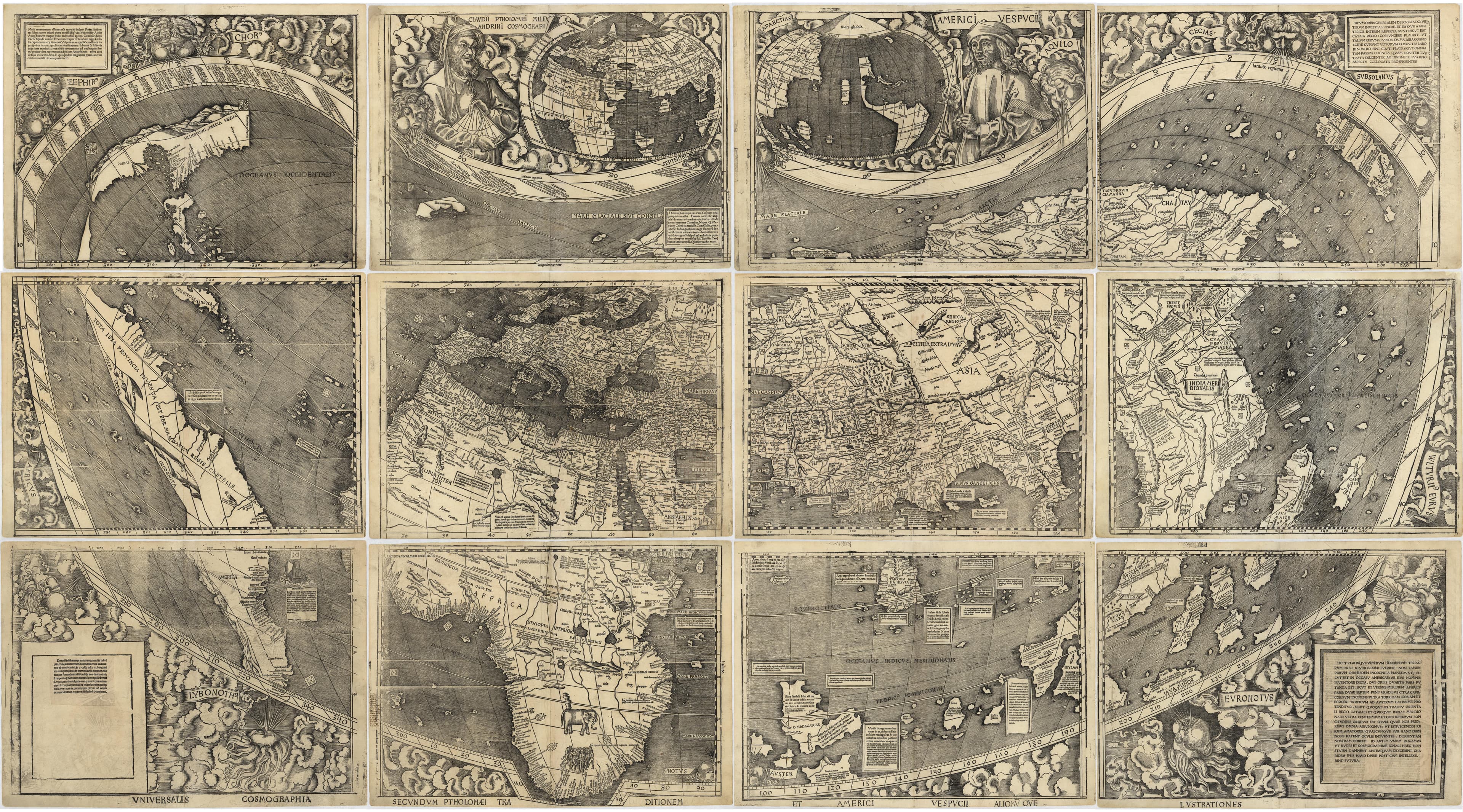
The Waldseemüller Map — Universalis Cosmographia, Martin Waldseemüller & Matthias Ringmann, 1507

1507

The Waldseemüller Map

America's birth certificate.

modified Ptolemaic
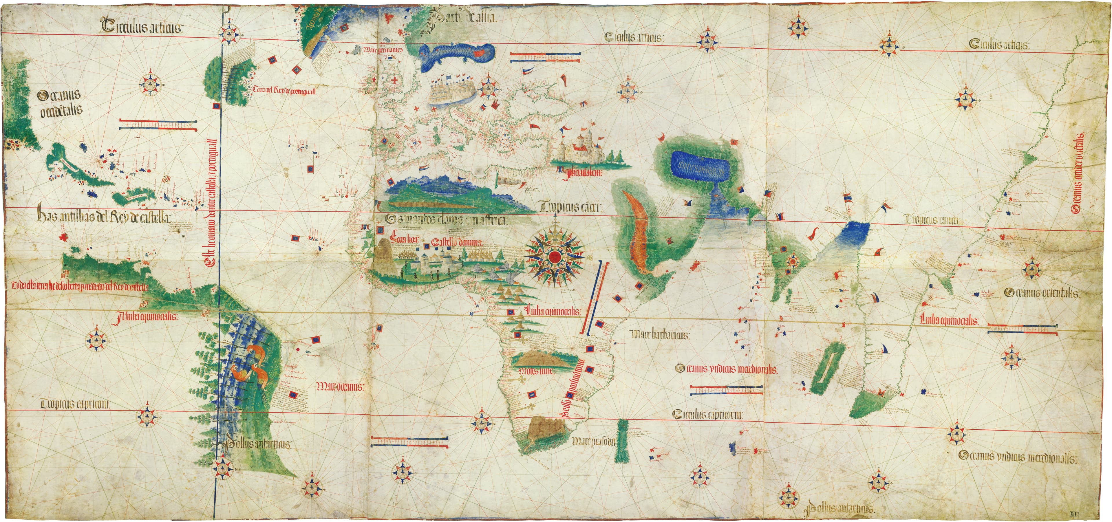
The Cantino Planisphere — Carta da navigar per le Isole novamente trovate, Anonymous Portuguese cartographer, 1502

1502

The Cantino Planisphere

A state secret, smuggled out of Portugal.
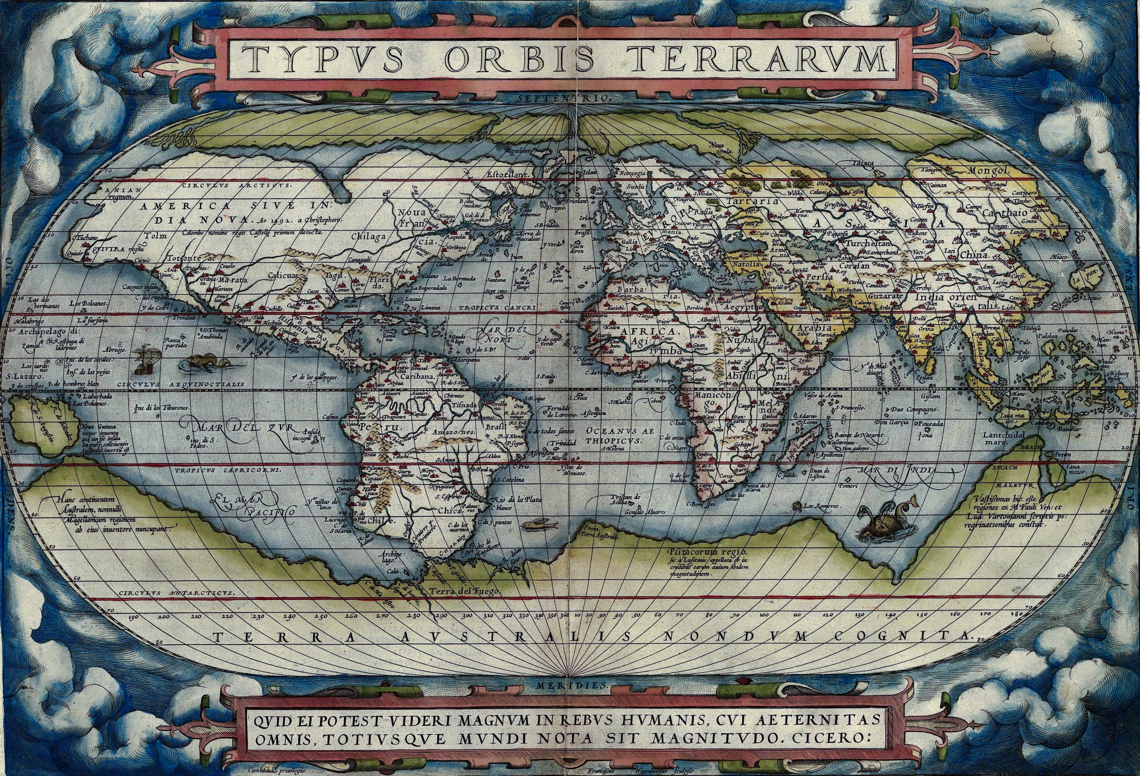
Typus Orbis Terrarum — Theatrum Orbis Terrarum, Abraham Ortelius, 1570

1570

Typus Orbis Terrarum

The world map from the first modern atlas.
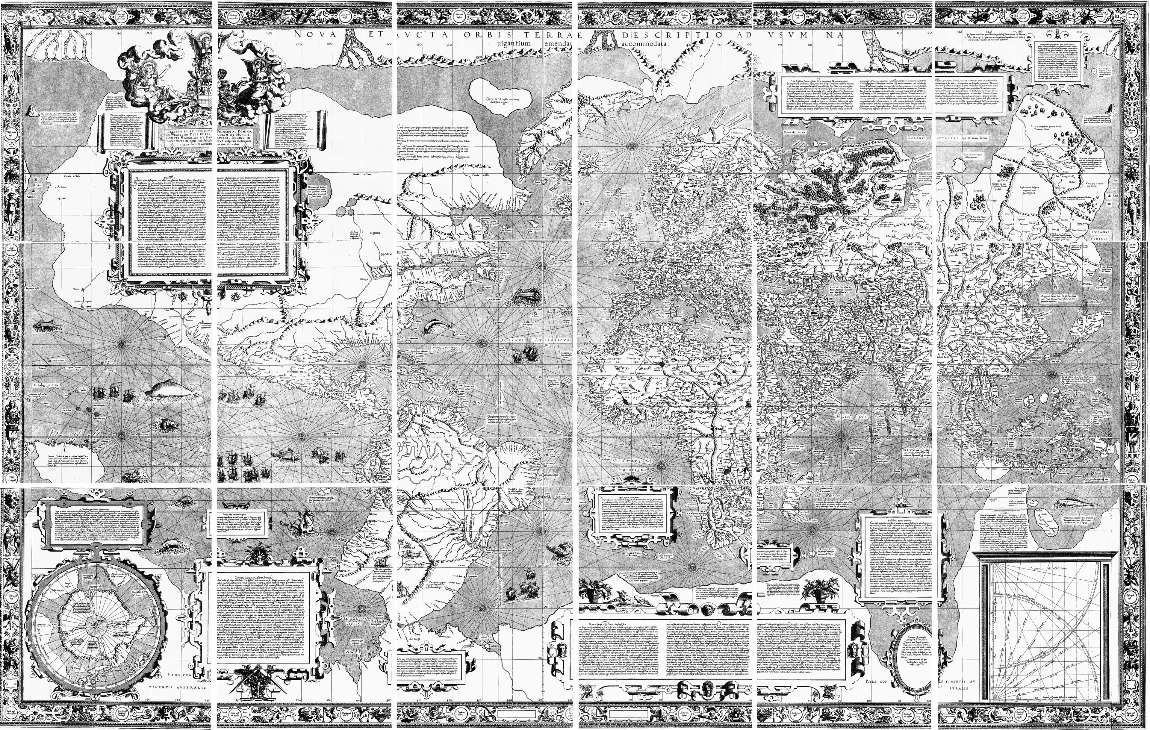
Mercator's World Map — Nova et Aucta Orbis Terrae Descriptio, Gerardus Mercator, 1569

1569

Mercator's World Map

The projection that let sailors steer a straight line.

Mercator
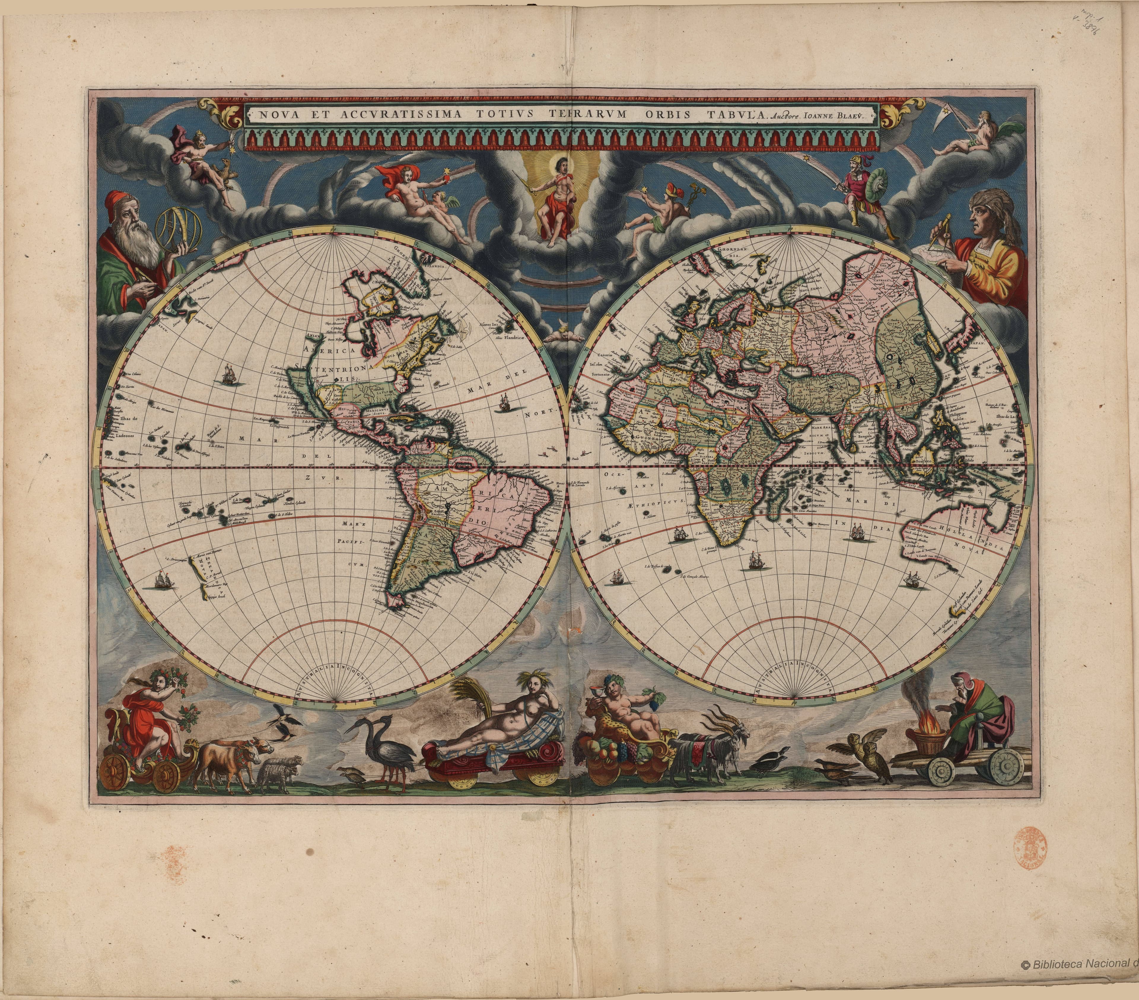
Nova Totius Terrarum Orbis — Nova Totius Terrarum Orbis Tabula, Willem & Joan Blaeu, 17th century

17th century

Nova Totius Terrarum Orbis

The Dutch Golden Age at its most magnificent.

double hemisphere
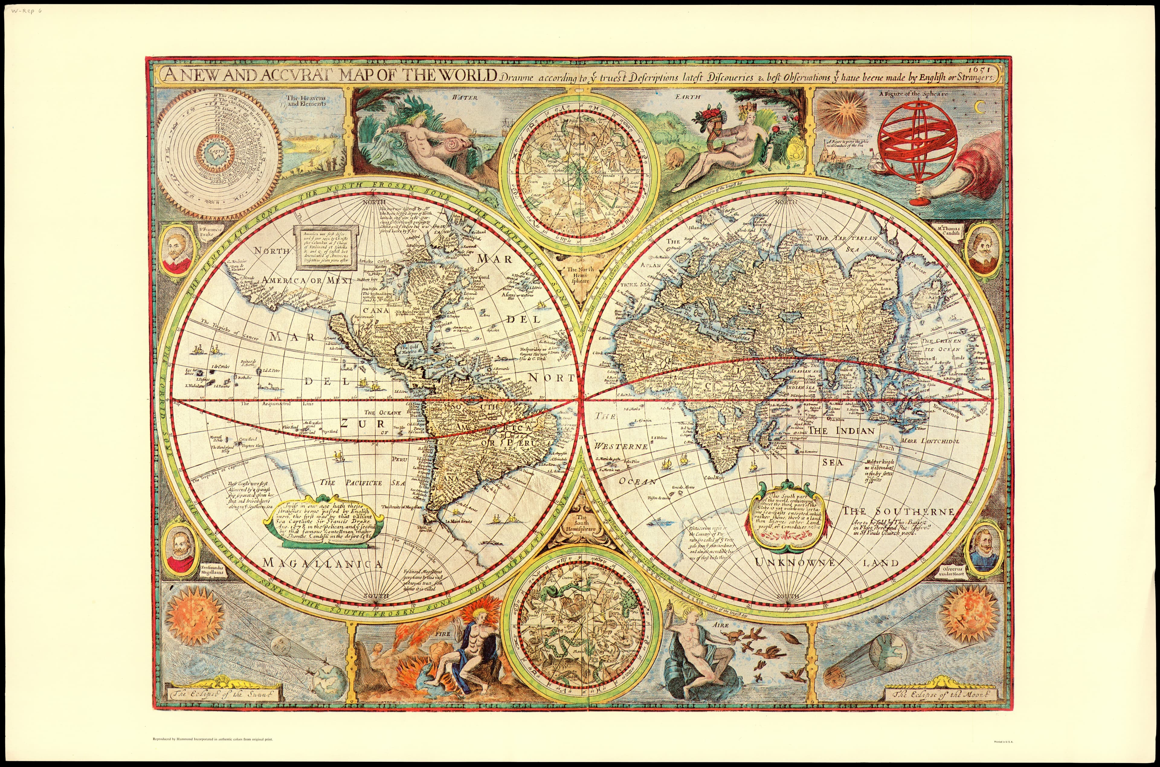
A New and Accurat Map of the World — A Prospect of the Most Famous Parts of the World, John Speed, 1627

1627

A New and Accurat Map of the World

The great English world map, ringed with wonders.

double hemisphere
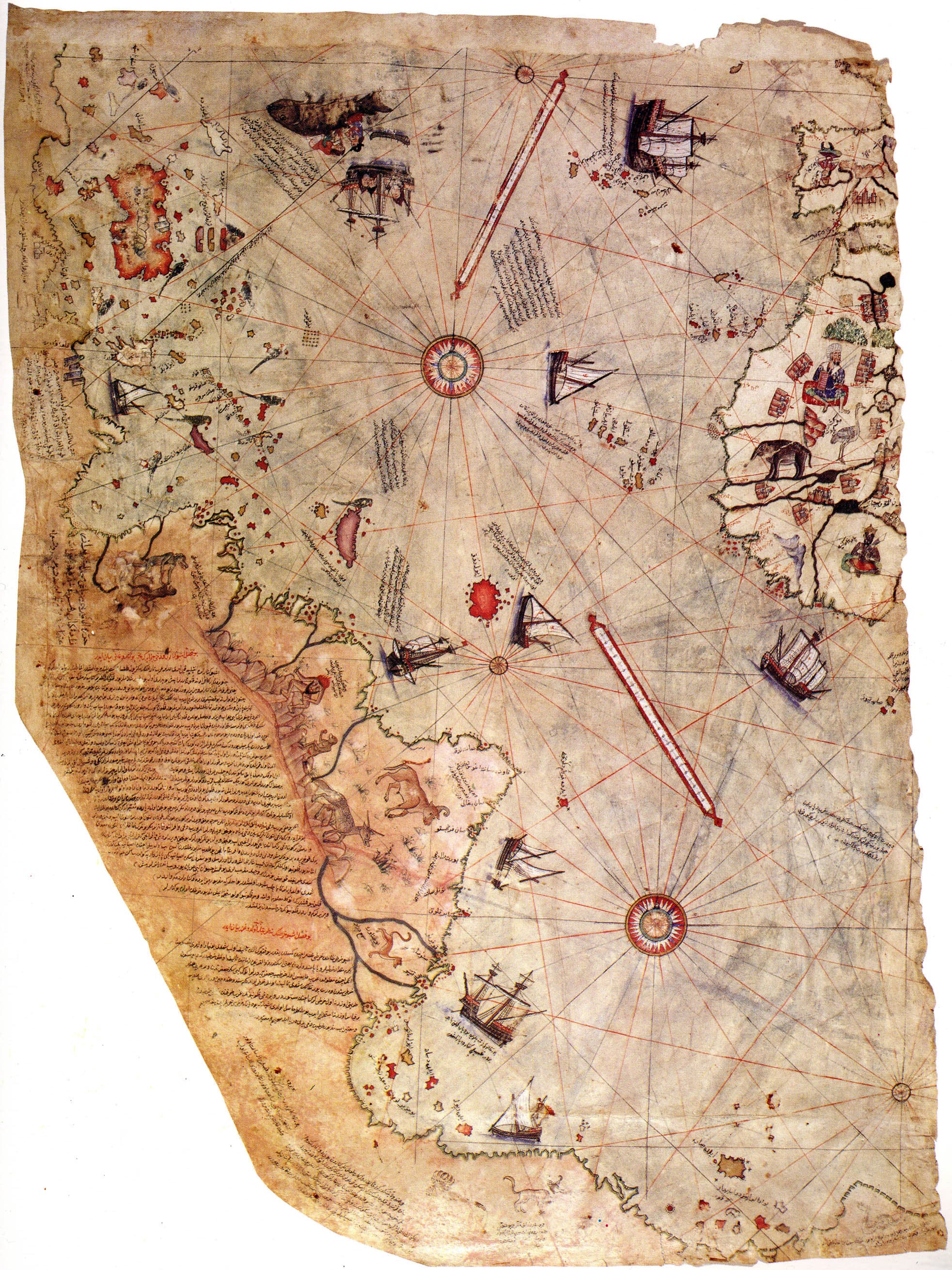
The Piri Reis Map — The Map of Piri Reis (surviving fragment), Piri Reis (Ottoman admiral), 1513

1513

The Piri Reis Map

An Ottoman admiral charts the New World.
The World in Figures — Nova Totius Terrarum Orbis geographica ac hydrographica tabula, Claes Janszoon Visscher, 1652

1652

The World in Figures

costumed figures down all four borders.

double hemisphere
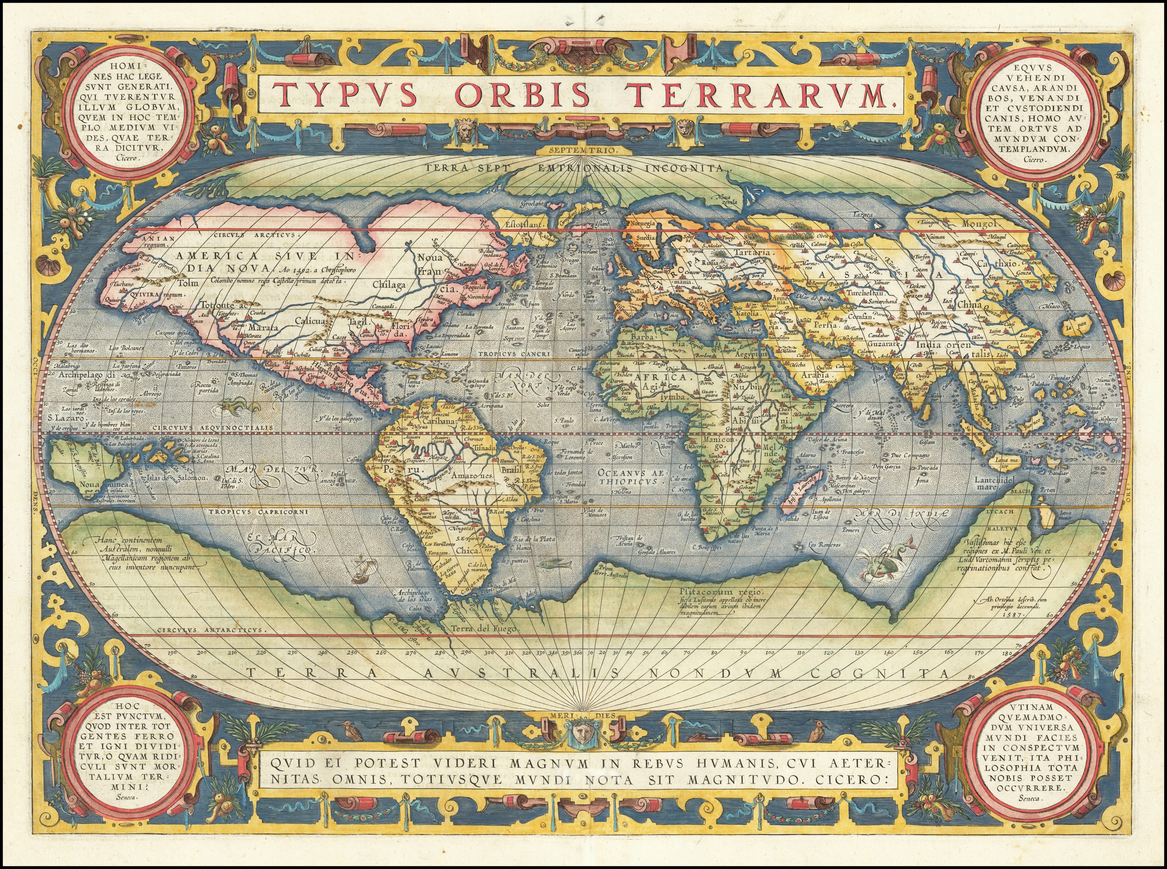
Typus Orbis Terrarum — Typus Orbis Terrarum, Abraham Ortelius, 1595

1595

Typus Orbis Terrarum

the cloud-scroll border.

oval
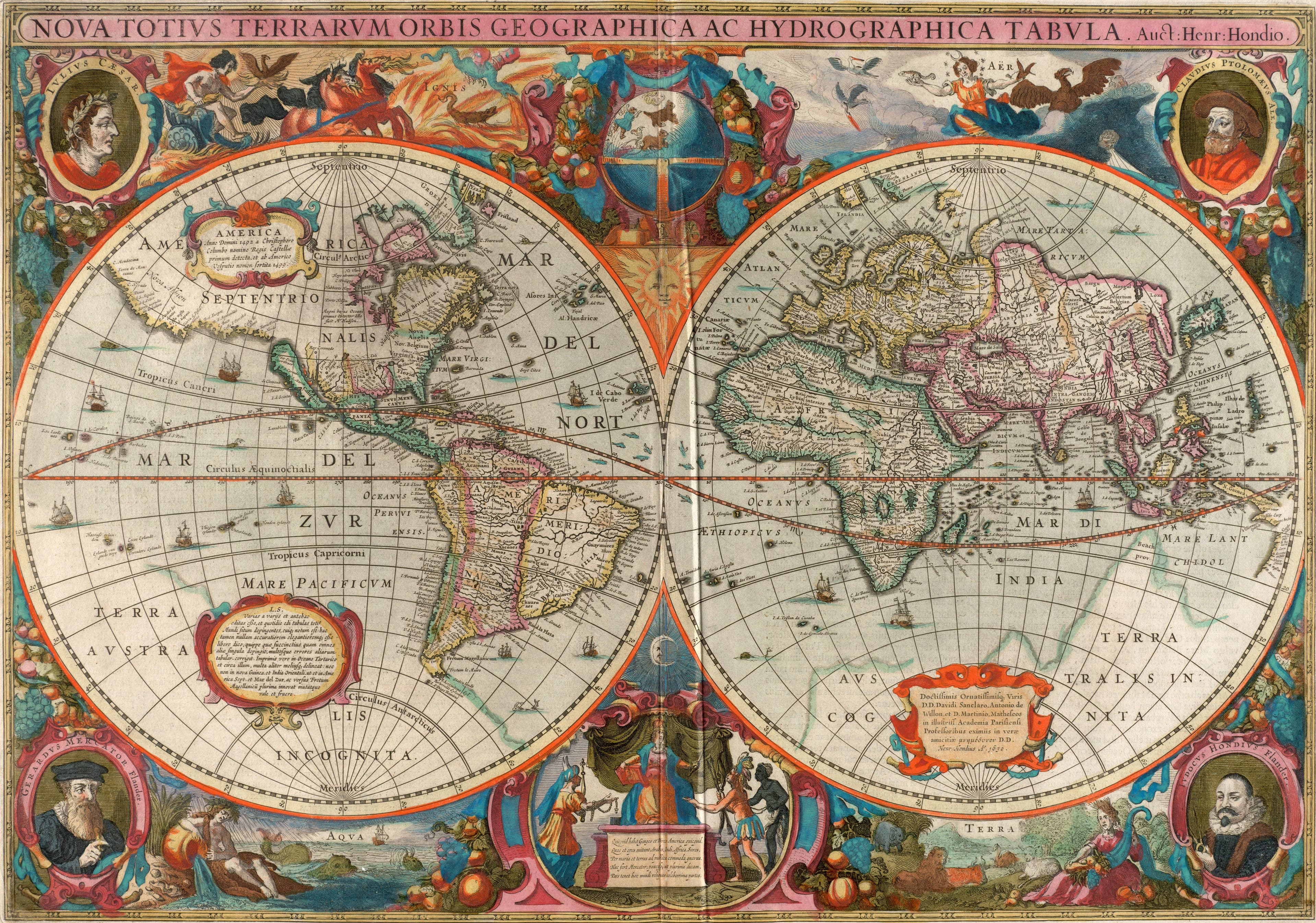
Hondius's World in Two Hemispheres — Nova totius terrarum orbis geographica ac hydrographica tabula, Henricus Hondius, 1630, printed 1638

1630, printed 1638

Hondius's World in Two Hemispheres

Both faces of the globe, framed by four mapmakers.

double hemisphere
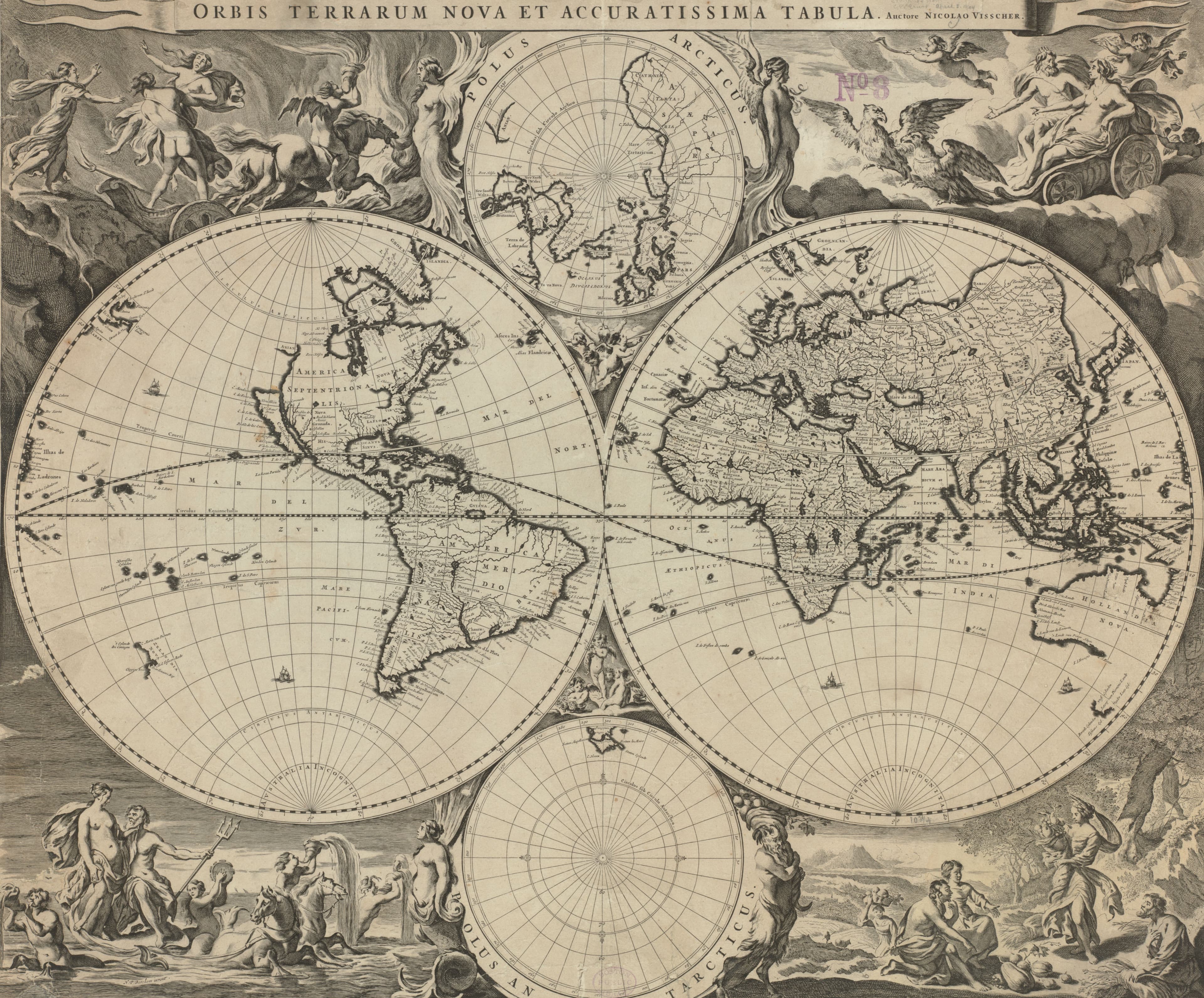
Visscher's World with the Poles — Orbis terrarum nova et accuratissima tabula, Nicolaes Visscher, c. 1690

c. 1690

Visscher's World with the Poles

Two hemispheres, two poles, four myths.

double hemisphere
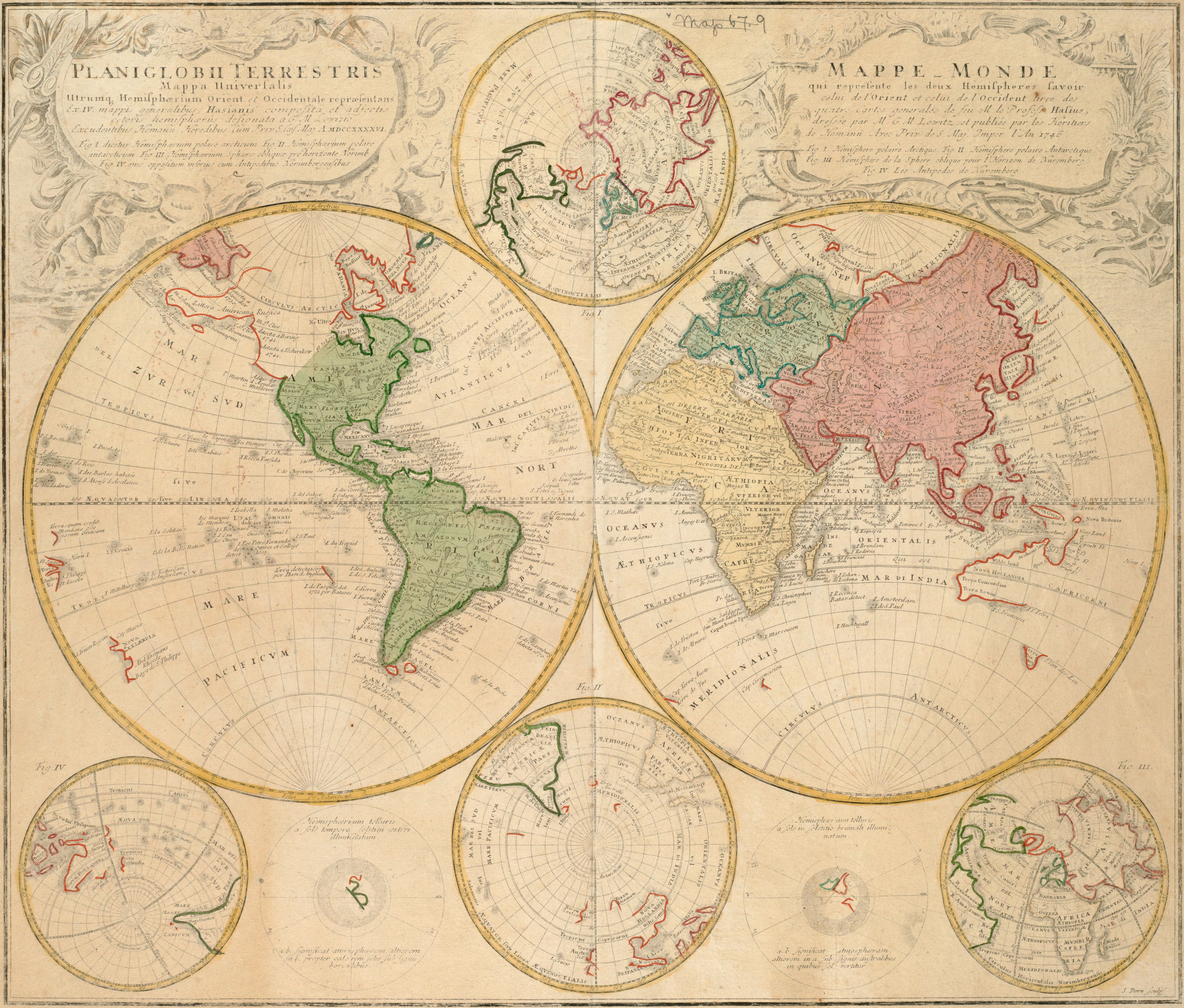
Hase's World for the Schoolroom — Planiglobii terrestris mappa universalis utrumque hemisphaerium orientale et occidentale repraesentans ex IV mappis generalibus, Johann Matthias Hase, 1746

1746

Hase's World for the Schoolroom

The two hemispheres, and six more ways to see a globe.

double hemisphere
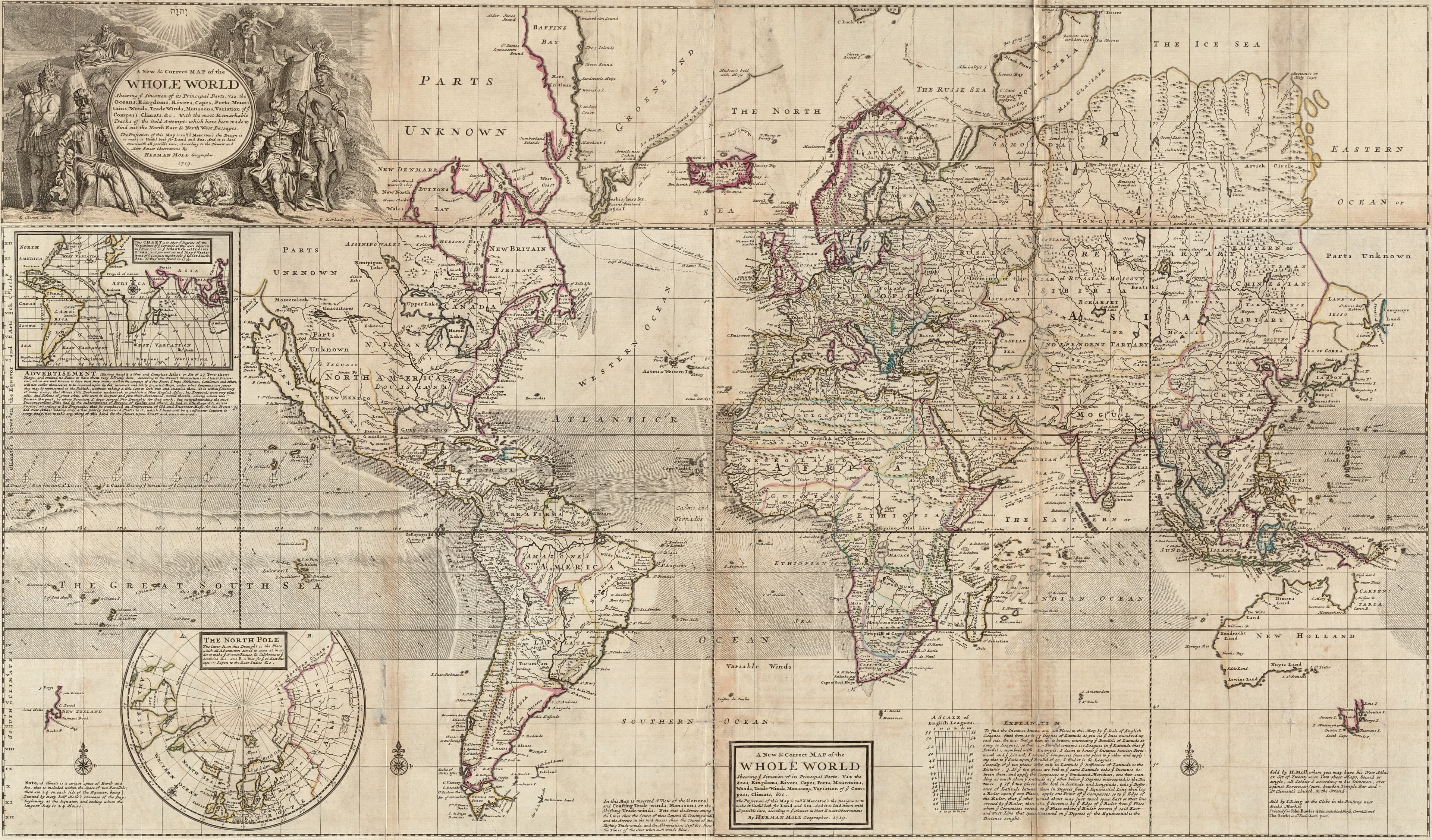
Moll's World of Winds — A new & correct map of the whole world, Herman Moll, 1719

1719

Moll's World of Winds

The trade winds, drawn as small arrows on the sea.
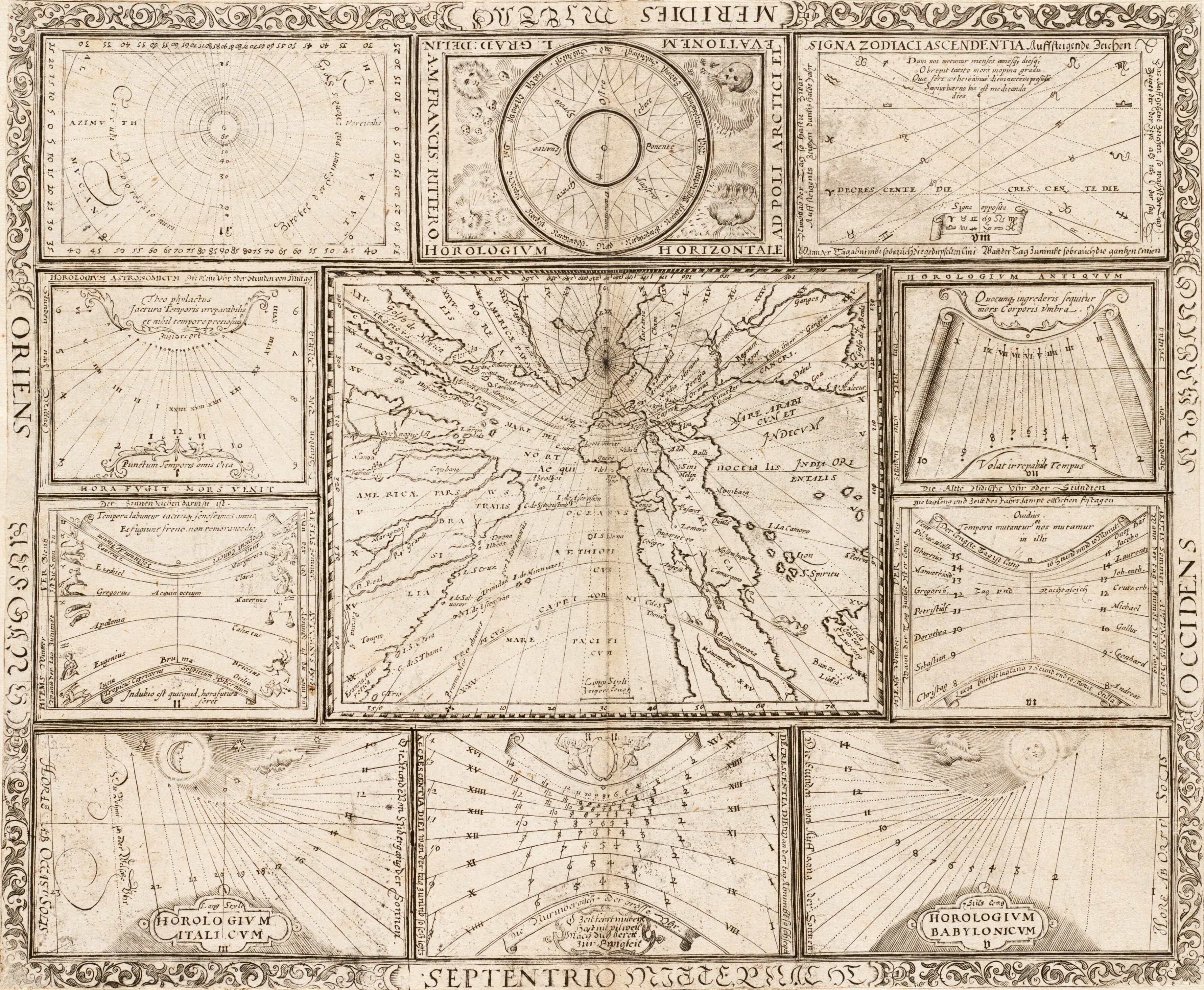
Ritter's World of the Sun — World map, from Speculum Solis, Franz Ritter, 1607

1607

Ritter's World of the Sun

A world map as a clock, with skulls for the south winds.

north at the south of the wind diagrampolar, from the North Pole
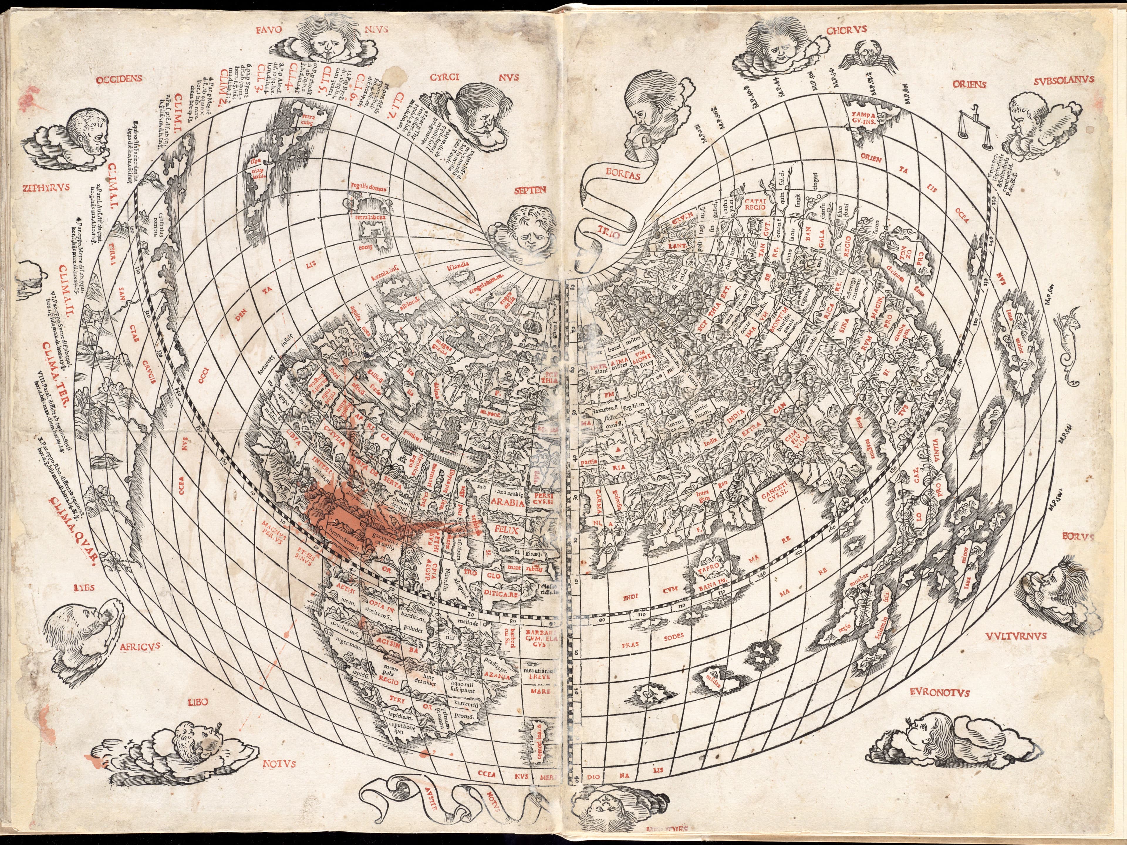
Silvani's Heart-Shaped World, 1511 — World map, from Ptolemy, Geographia, Bernardo Silvani, 1511

1511

Silvani's Heart-Shaped World, 1511

The world as a heart, printed in red and black.

cordiform
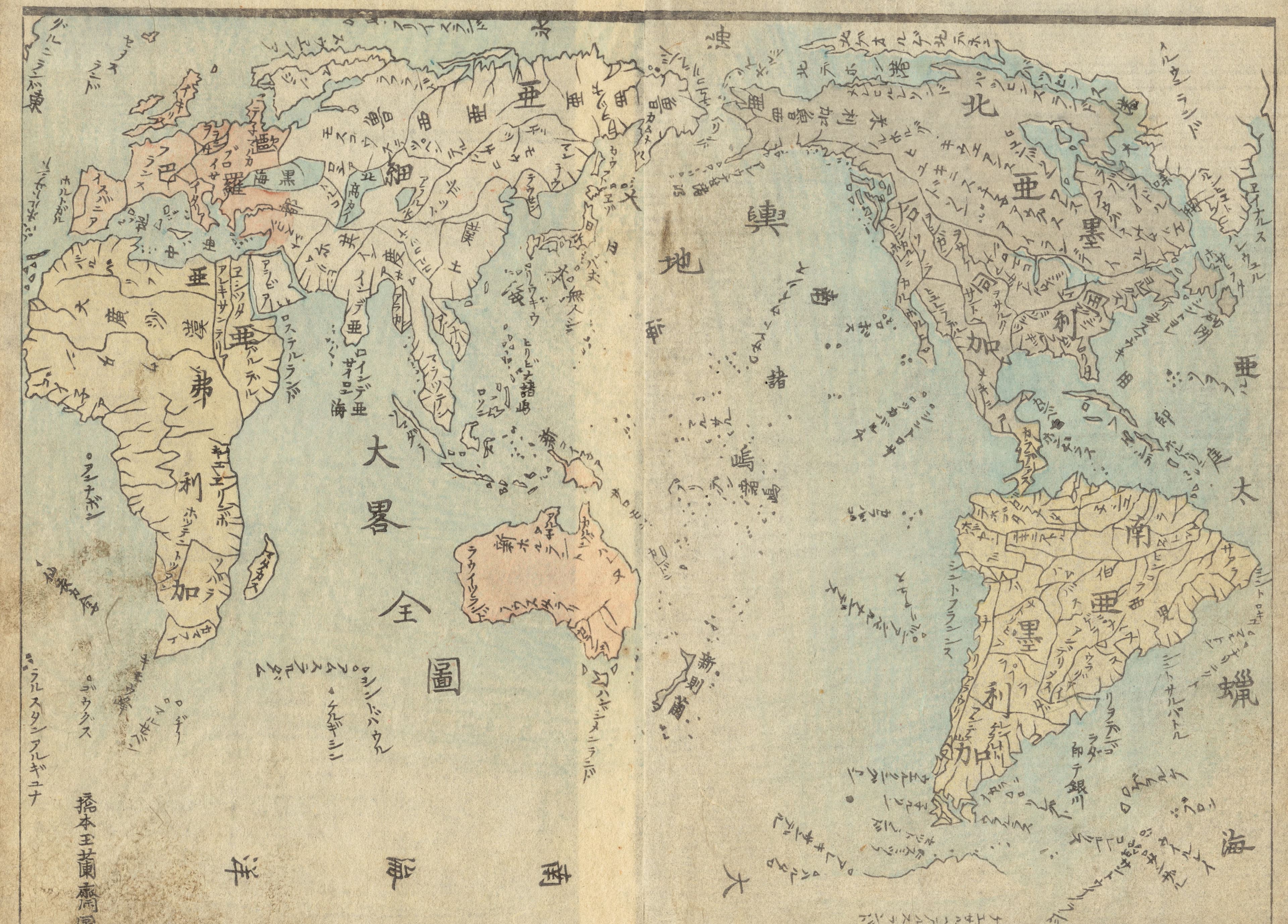
Tsurumine's World, Edo, 1844 — Map of the world, in Japanese, Tsurumine Shigenobu, 1844

1844

Tsurumine's World, Edo, 1844

The whole world, printed from woodblocks in 1844.
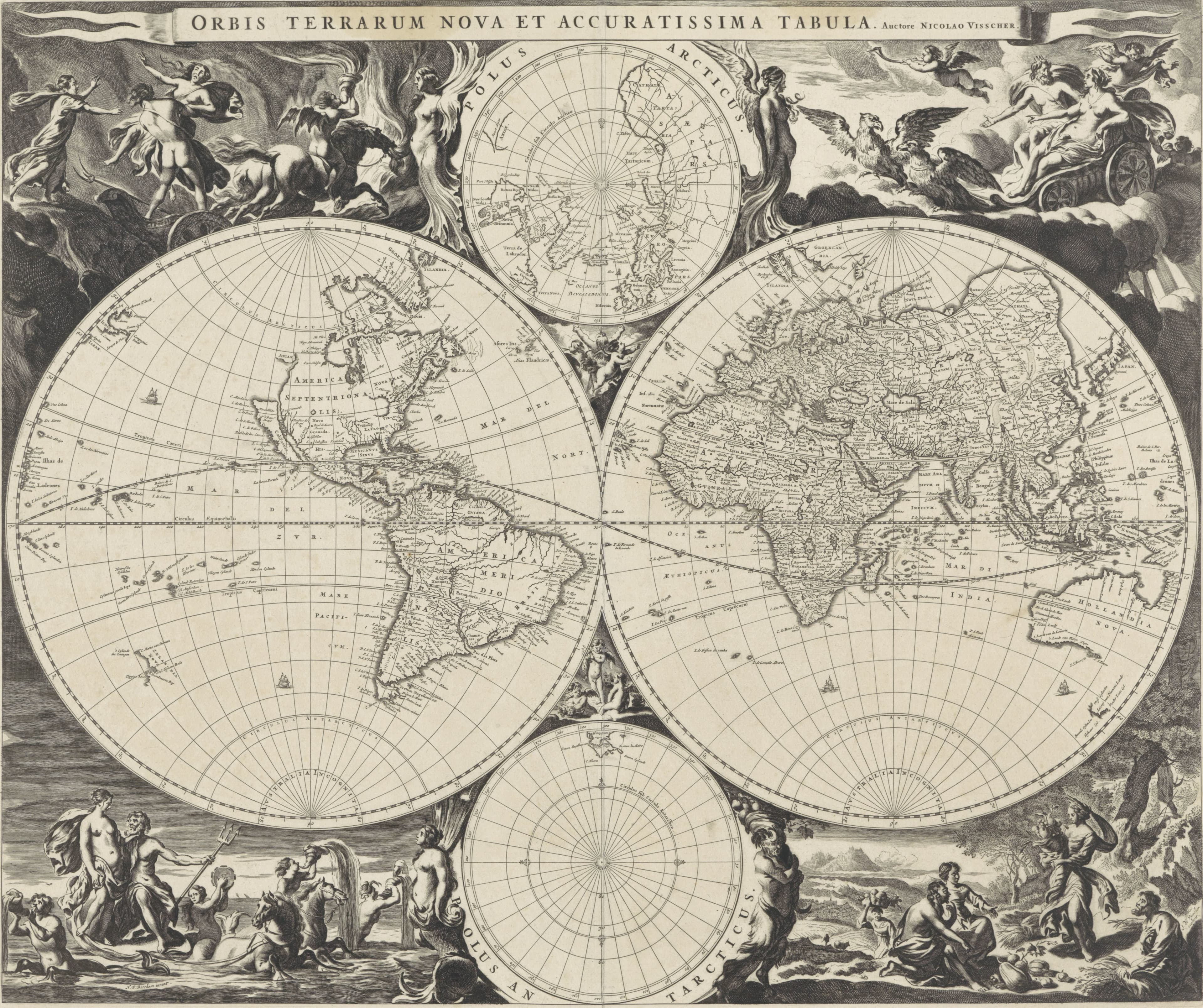
Visscher's World of the Four Elements — Map of the World, Nicolaes Visscher I, c. 1670 to 1680

c. 1670 to 1680

Visscher's World of the Four Elements

Air, fire, water and earth, one in each corner.

double hemisphere
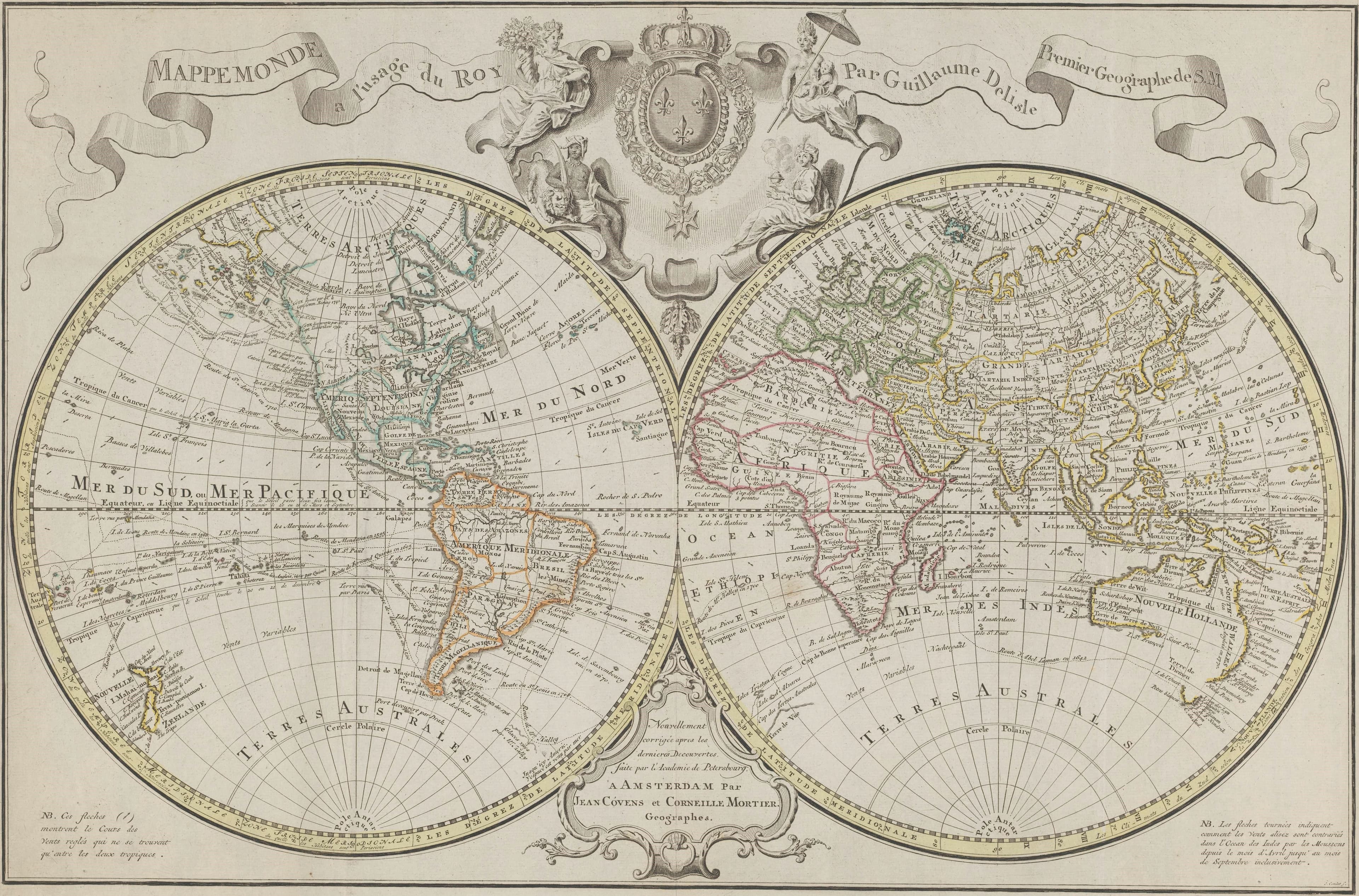
Delisle's World for the King — Mappemonde a l'usage du roy, Guillaume Delisle; published by Covens and Mortier, 1721 to 1774

1721 to 1774

Delisle's World for the King

The world made for the king's use, reprinted in Amsterdam.

double hemisphere
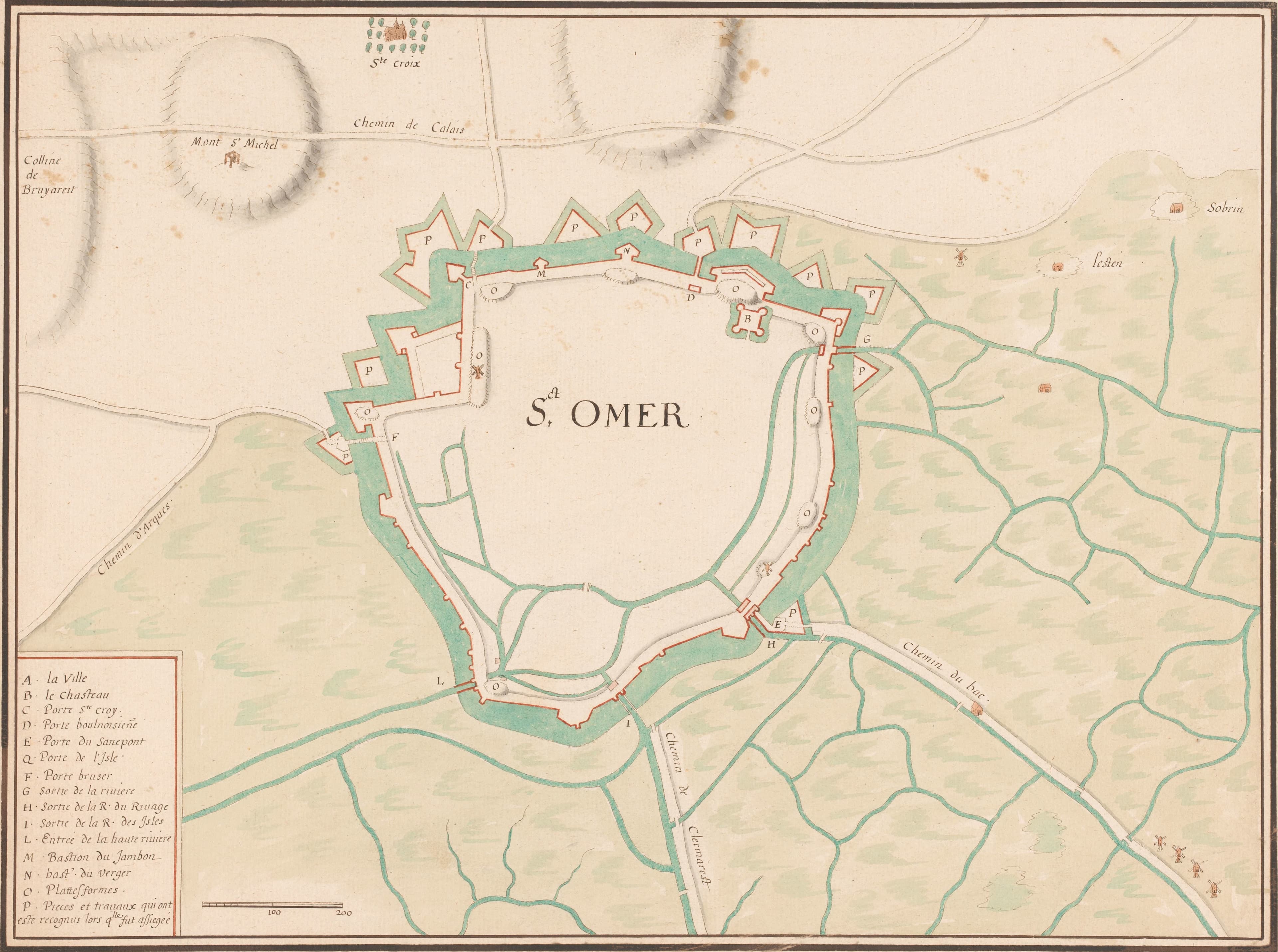
Stopendael's World Between Two Heavens — Orbis terrarum tabula recens emendata et in lucem edita, Bastiaen Stopendael, 1682

1682

Stopendael's World Between Two Heavens

Copernicus above the Earth, Ptolemy below it.
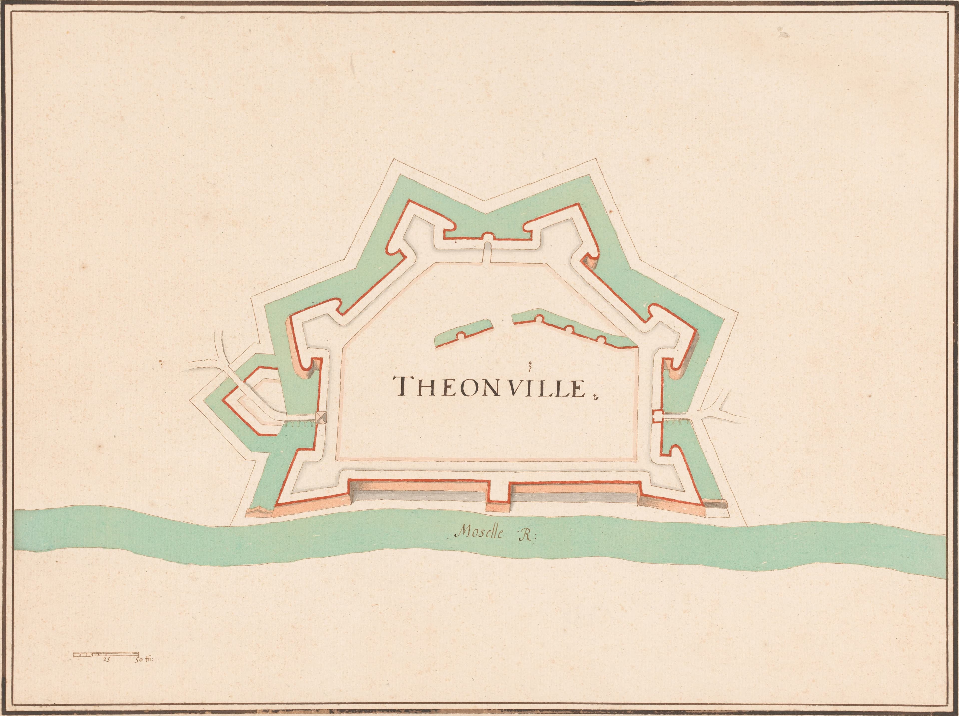
The Voyages of Captain Cook — Algemeene kaart van de ontdekkingen van kapit. J. Cook, Cornelis van Baarsel, after Henry Roberts, 1780 to 1796

1780 to 1796

The Voyages of Captain Cook

Captain Cook's voyages, traced round the world.
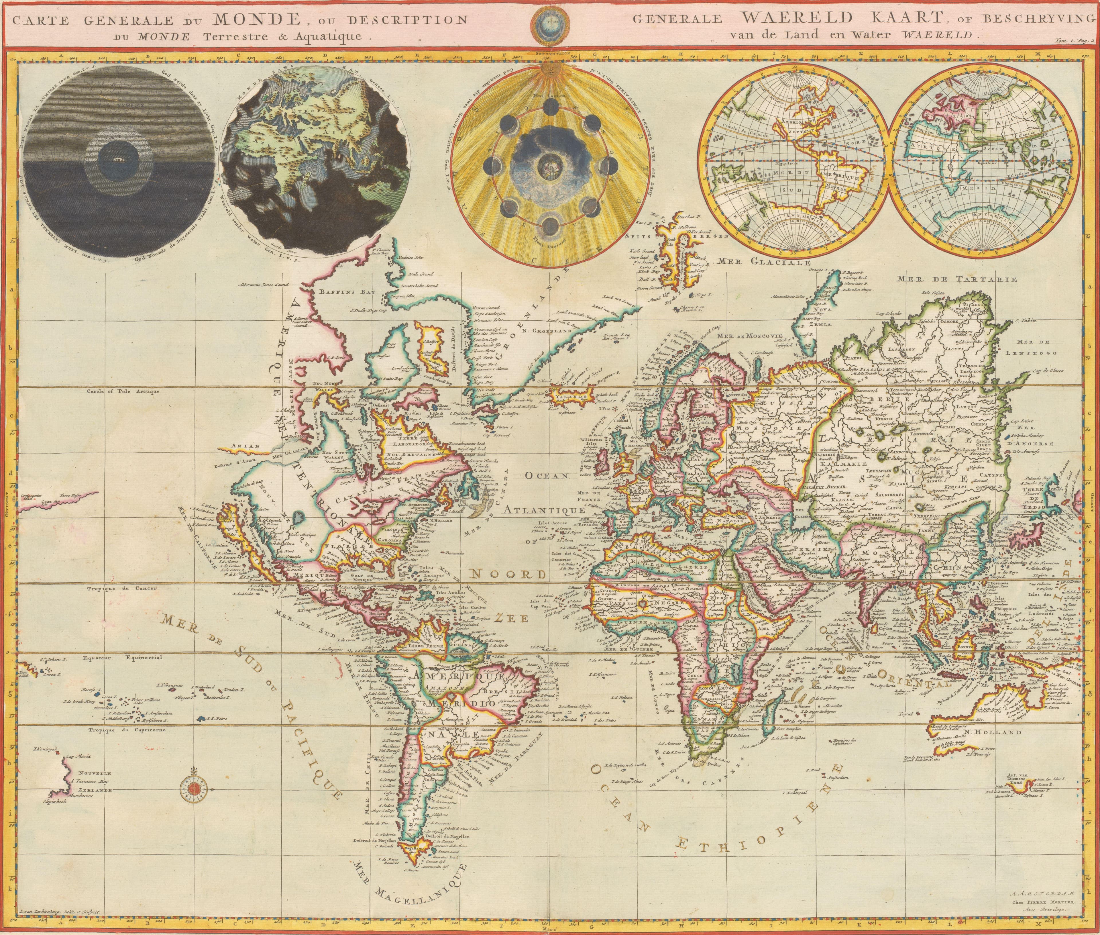
Mortier's World for the Bible — Carte generale du monde, ou Description du monde terrestre & aquatique, Pieter Mortier I, 1700

1700

Mortier's World for the Bible

Five globes, three of them from Genesis.