Cartographer’s Dream

E 4° — THE DREAM

Cartographic Wonders

The map at its most dreamlike — a queen, a lion, the country of love, a world drawn as a heart.
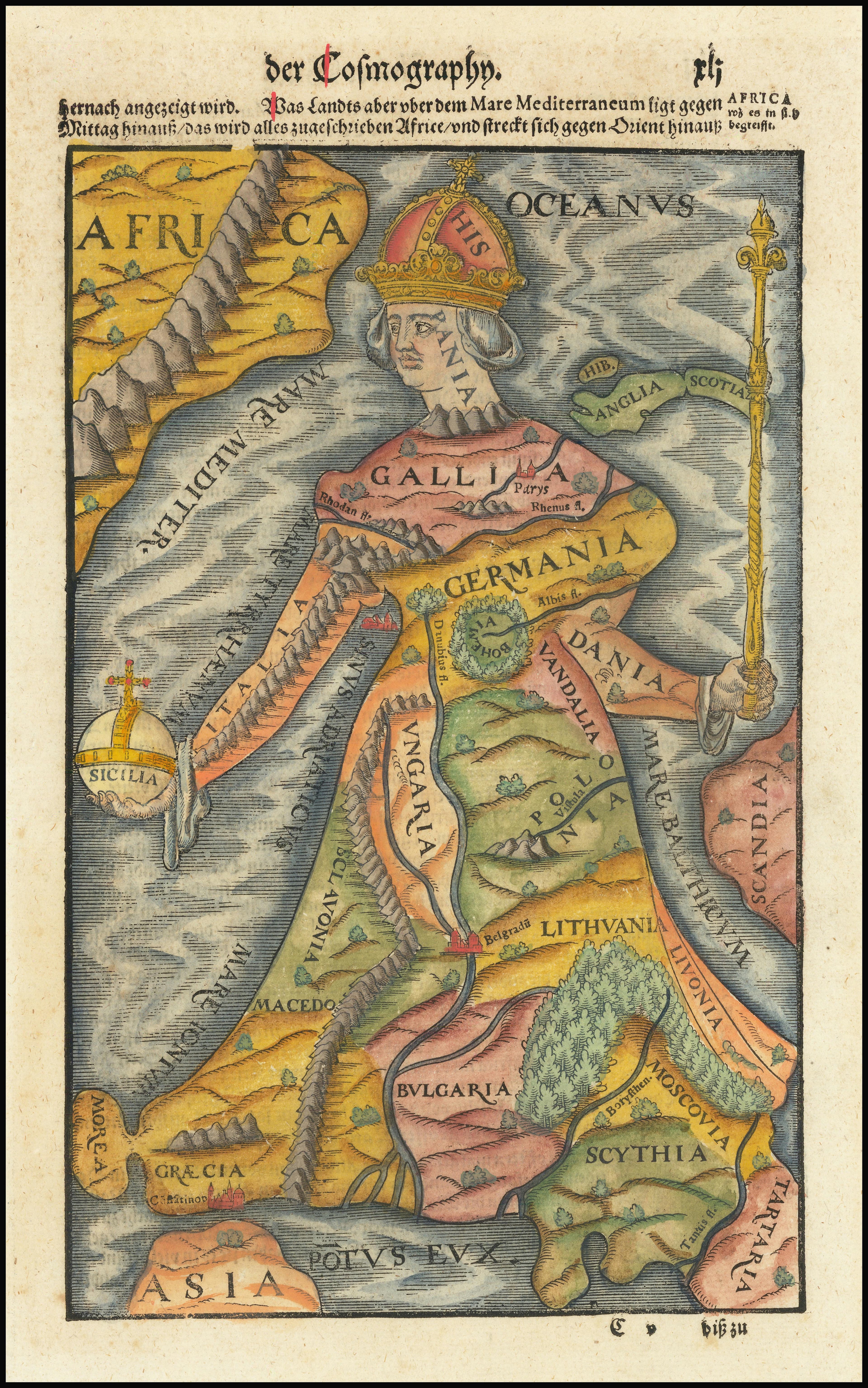
Europa Regina — Europa Regina, Johannes Putsch; popularized by Sebastian Münster, 1537 (later editions)

1537 (later editions)

Europa Regina

Europe as a crowned queen.

west-up
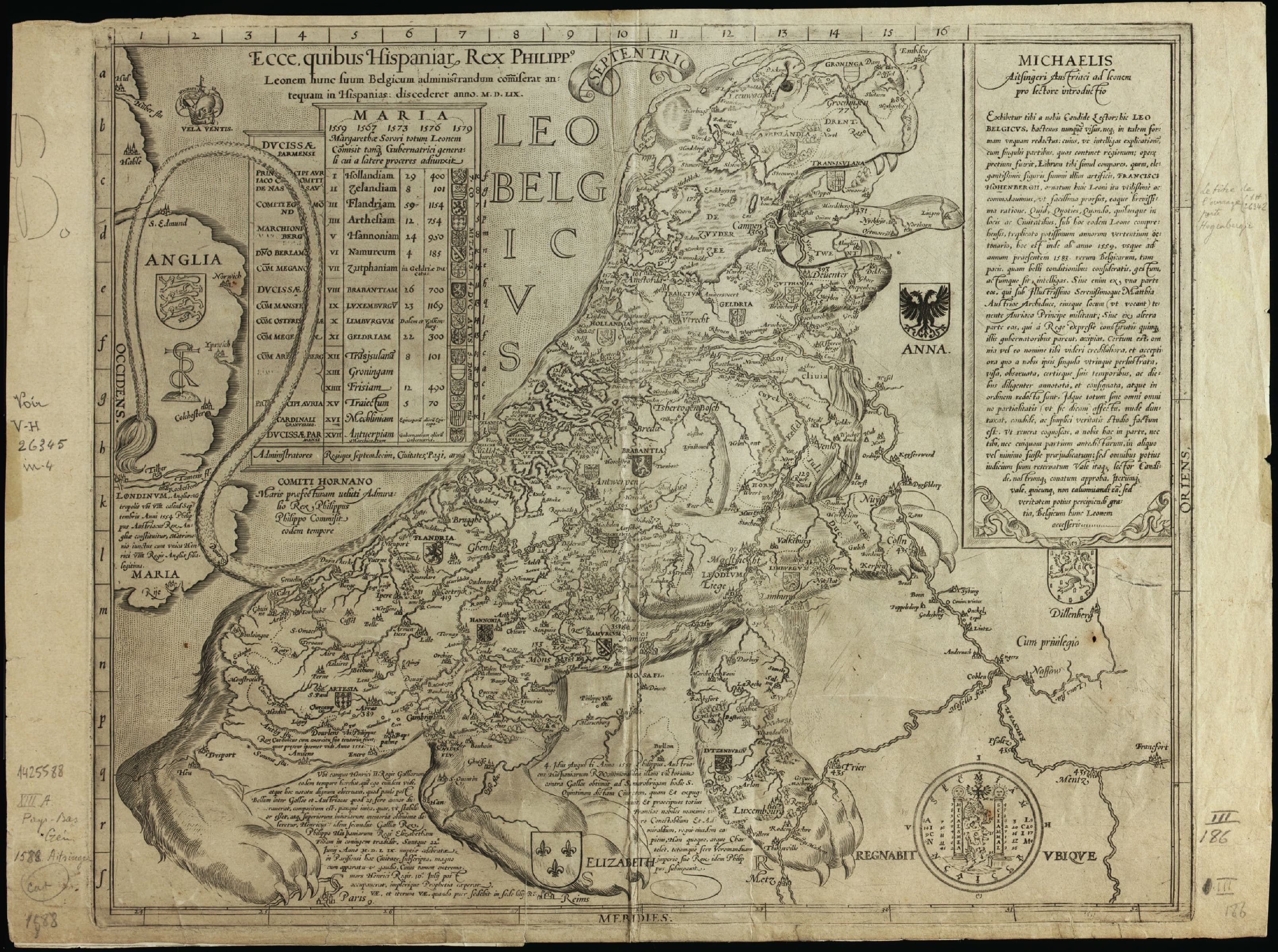
Leo Belgicus — Leo Belgicus, Michael Aitzinger; Claes Janszoon Visscher, 1583 (later editions)

1583 (later editions)

Leo Belgicus

The Low Countries as a rampant lion.
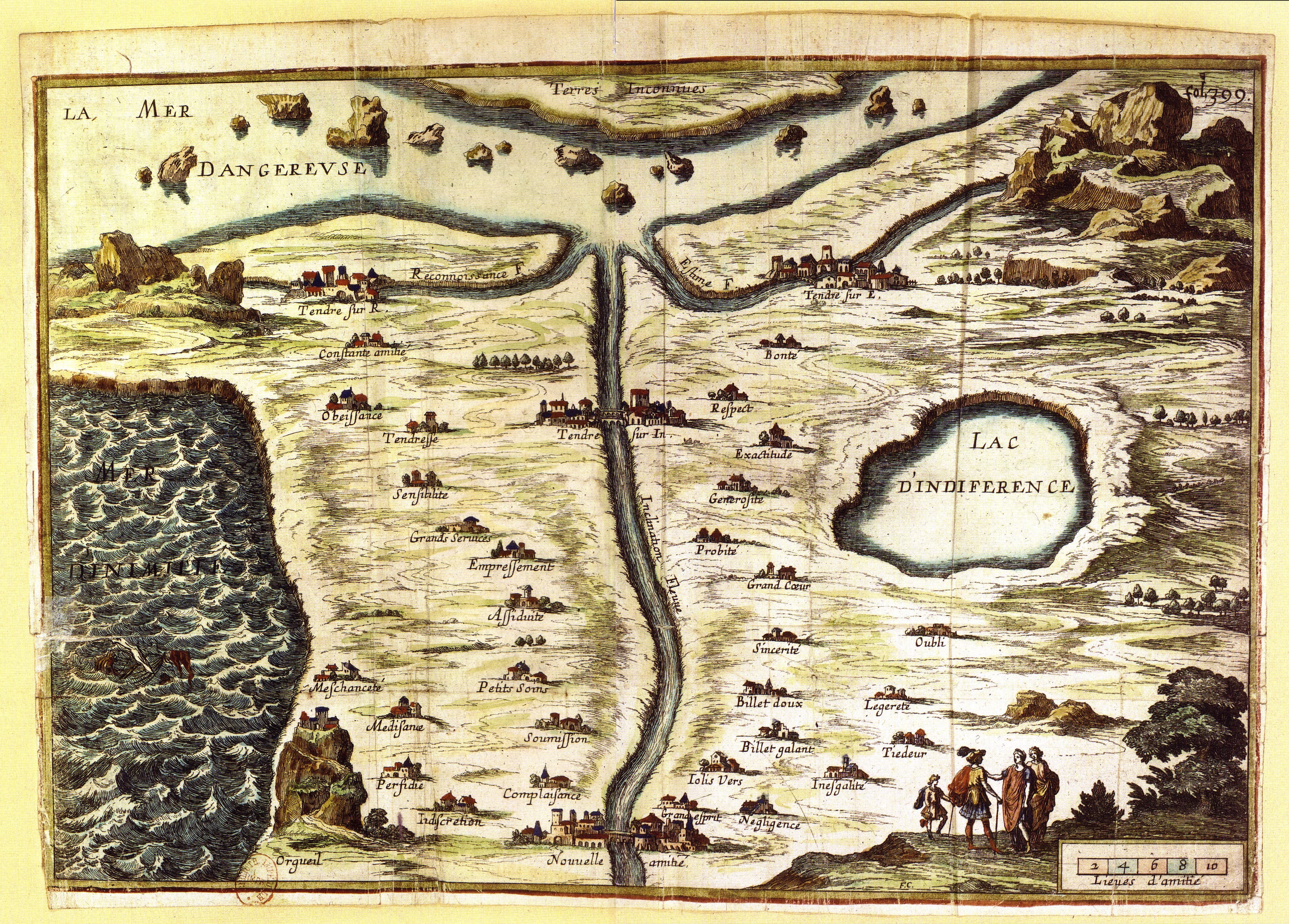
The Carte de Tendre — Carte de Tendre, Madeleine de Scudéry; engraved by François Chauveau, 1654

1654

The Carte de Tendre

A map of the country of love.
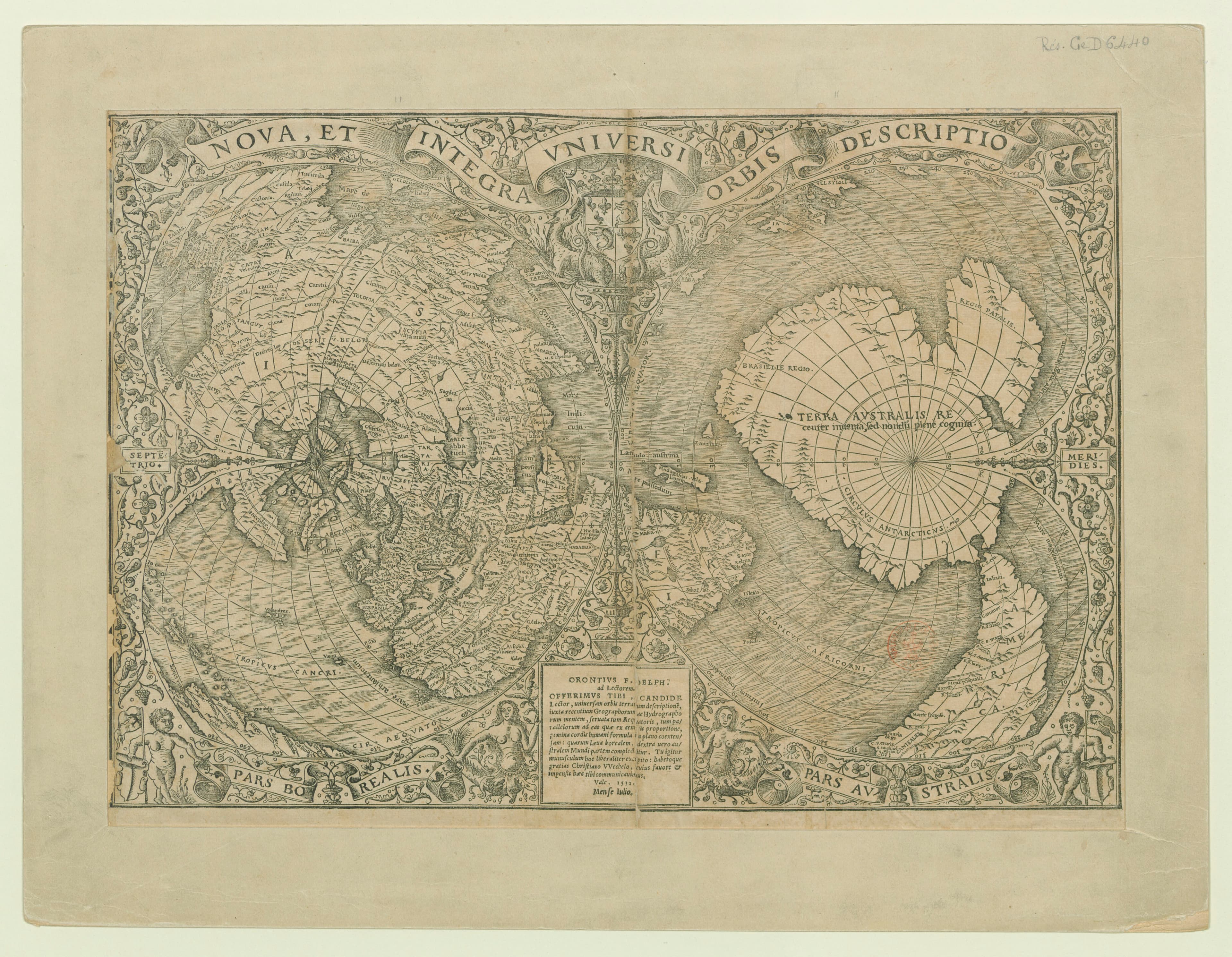
The Heart-Shaped World — Recens et integra orbis descriptio, Oronce Finé, 1531

1531

The Heart-Shaped World

The whole Earth, drawn as a heart.

cordiform (heart-shaped)
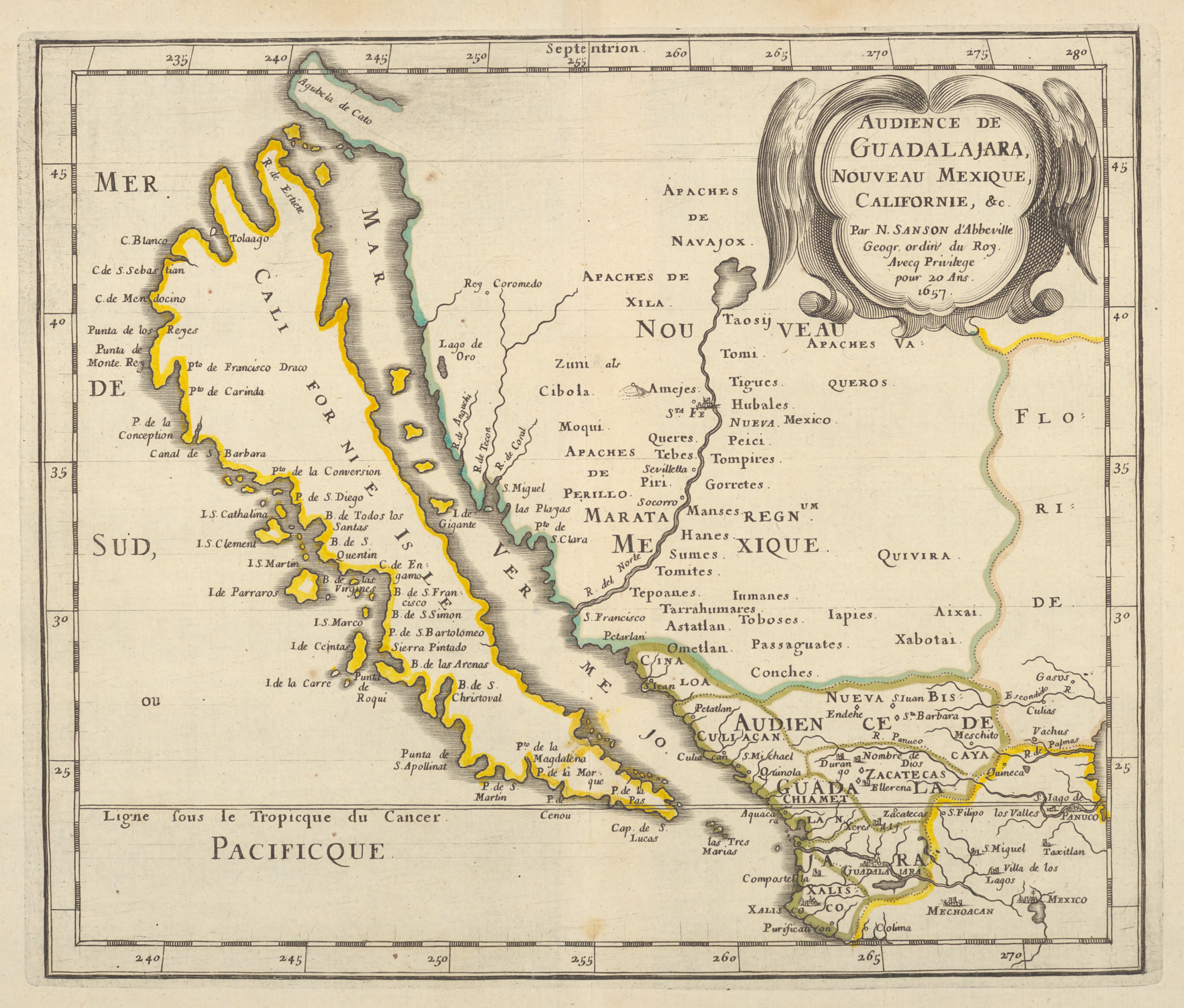
California as an Island — A map of the California-as-an-island tradition, Nicolas Sanson / Joan Vinckeboons and others, c. 1650

c. 1650

California as an Island

The most beautiful mistake in cartography.
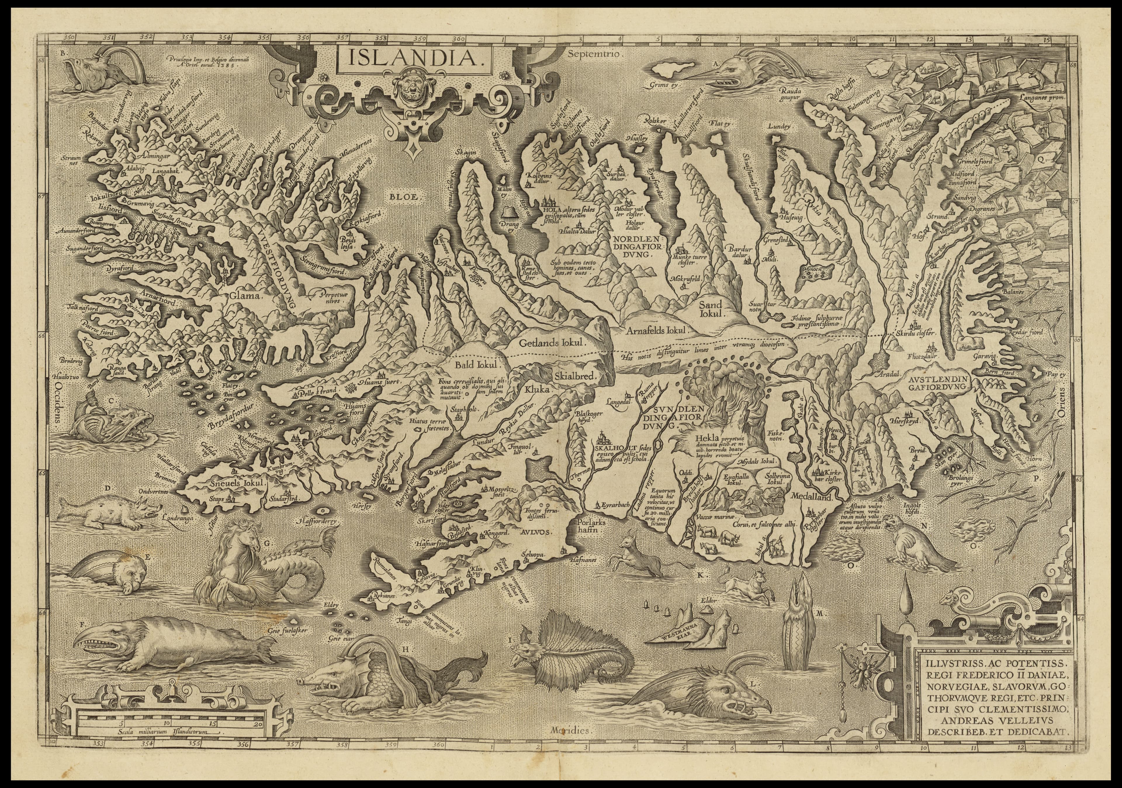
Islandia — Islandia, Abraham Ortelius, 1585

1585

Islandia

a dozen lettered sea monsters in the surrounding ocean.

regional
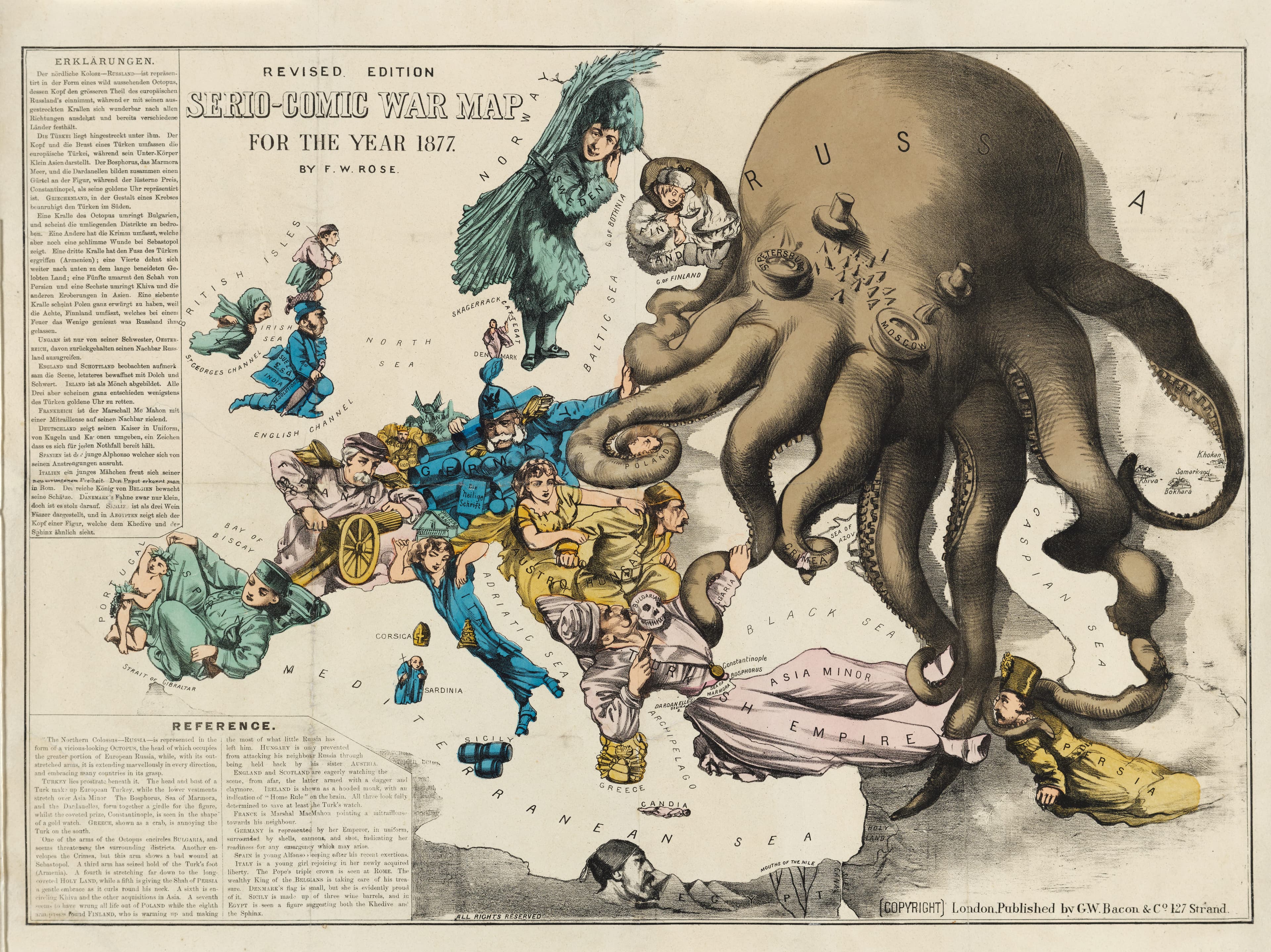
The Octopus — Serio-Comic War Map for the Year 1877, Fred W. Rose, 1877

1877

The Octopus

Russia drawn as an octopus, tentacles across Europe.

persuasive
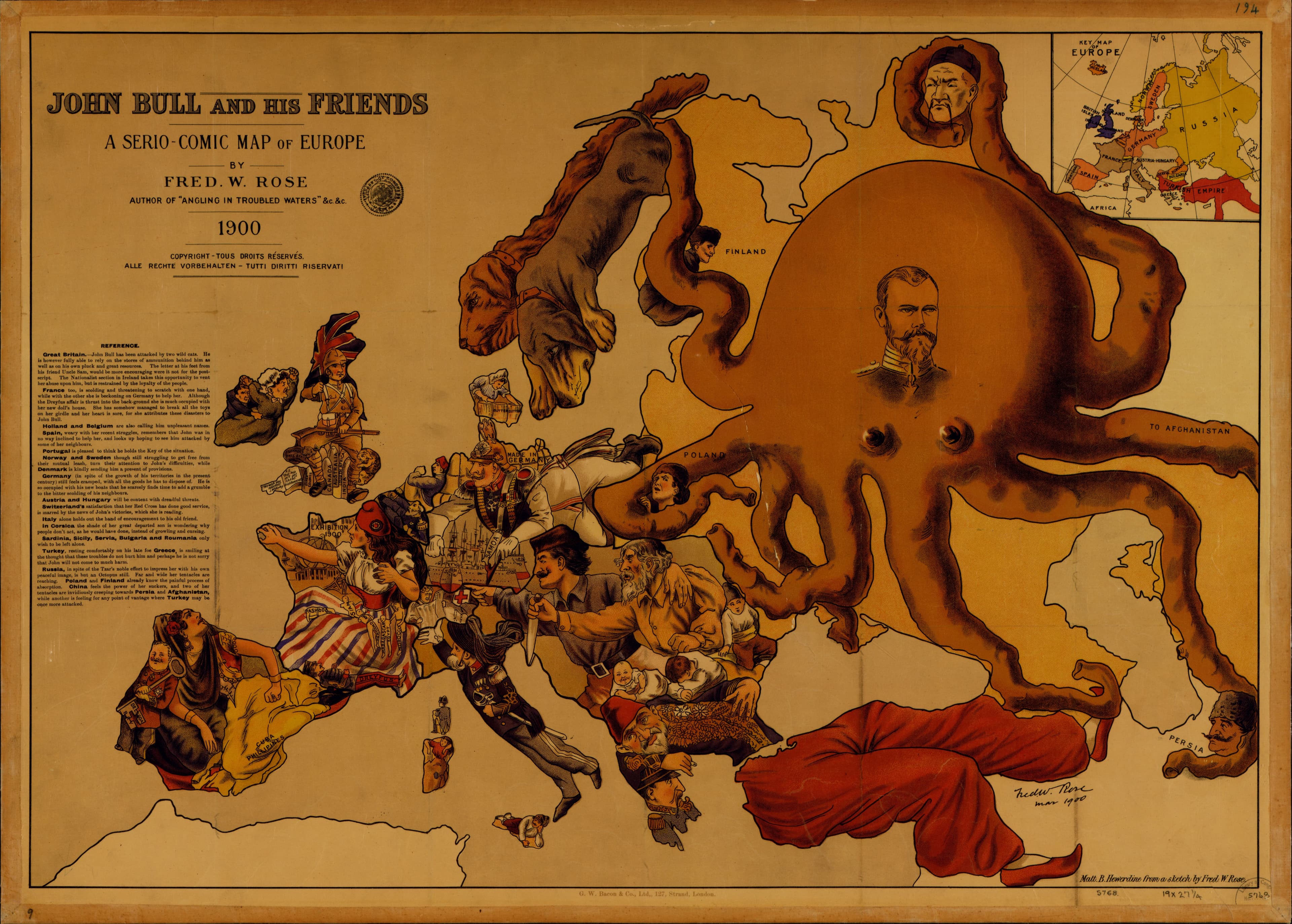
John Bull and His Friends — John Bull and His Friends: A Serio-Comic Map of Europe, Fred W. Rose, 1900

1900

John Bull and His Friends

the octopus returned, twenty-three years on.

persuasive
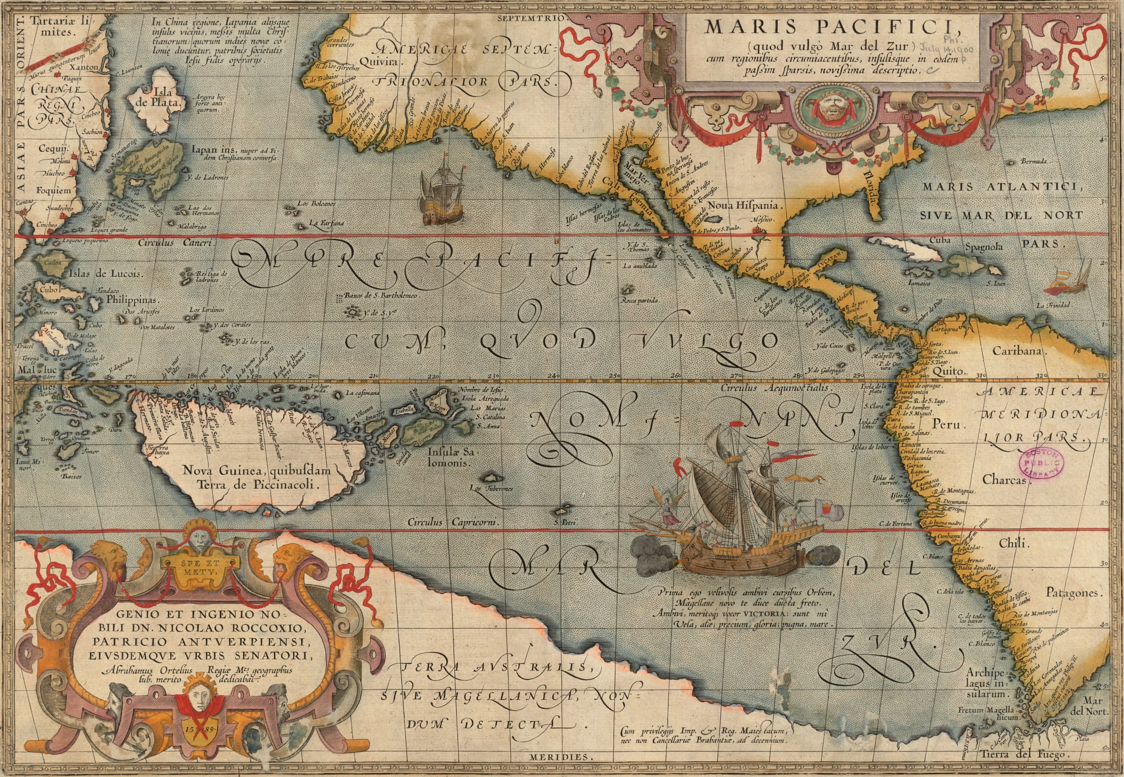
Ortelius, the Pacific Ocean — Maris Pacifici (quod vulgo Mar del Zur) cum regionibus circumiacentibus, insulisque in eodem passim sparsis, novissima descriptio, Abraham Ortelius, 1589, printed 1612

1589, printed 1612

Ortelius, the Pacific Ocean

The great South Sea, given a sheet of its own.
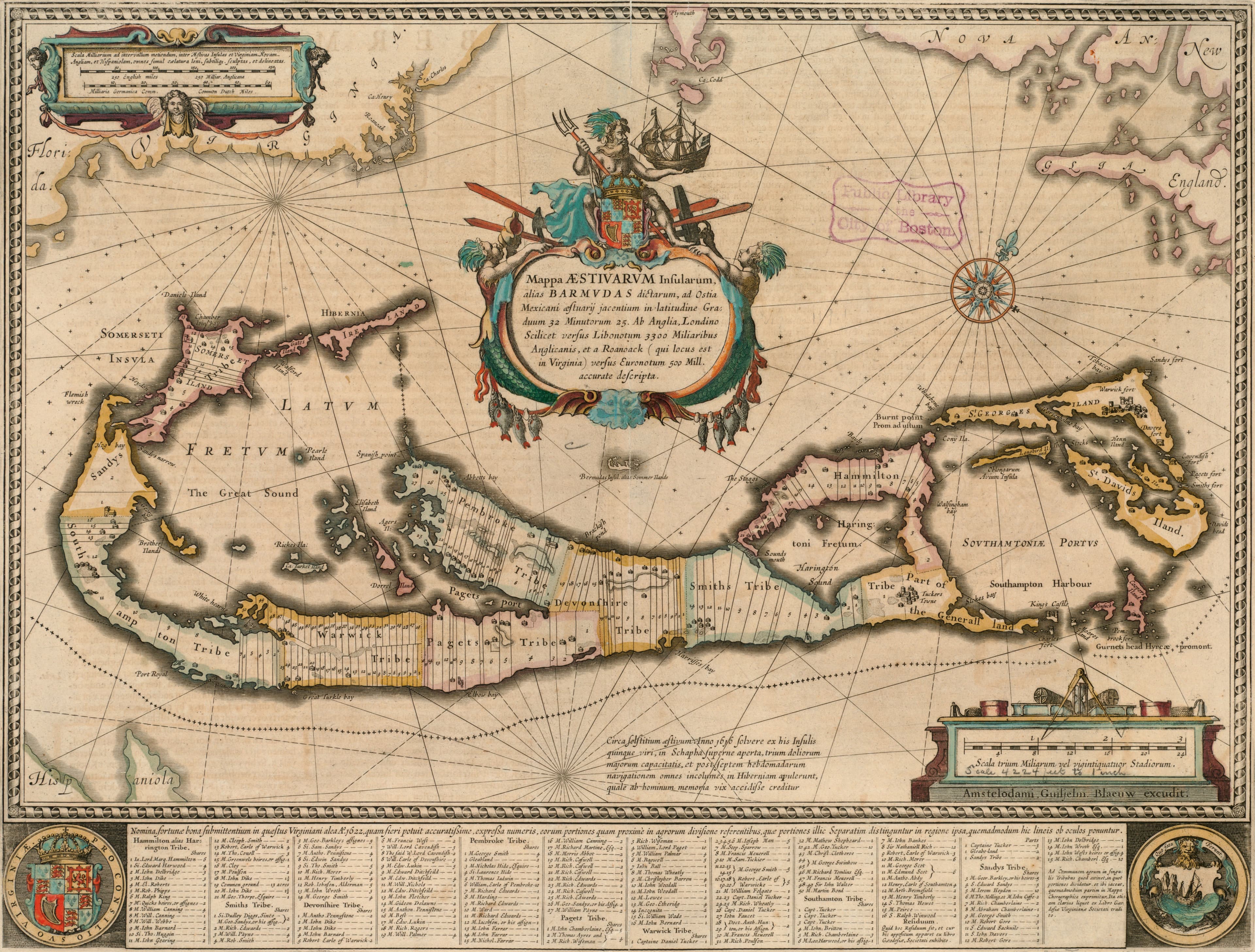
Blaeu's Bermuda — Mappa aestivarum insularum, alias Barmudas dictarum, Willem Janszoon Blaeu, c. 1662

c. 1662

Blaeu's Bermuda

The Summer Islands, with every landowner named.

north to the upper right
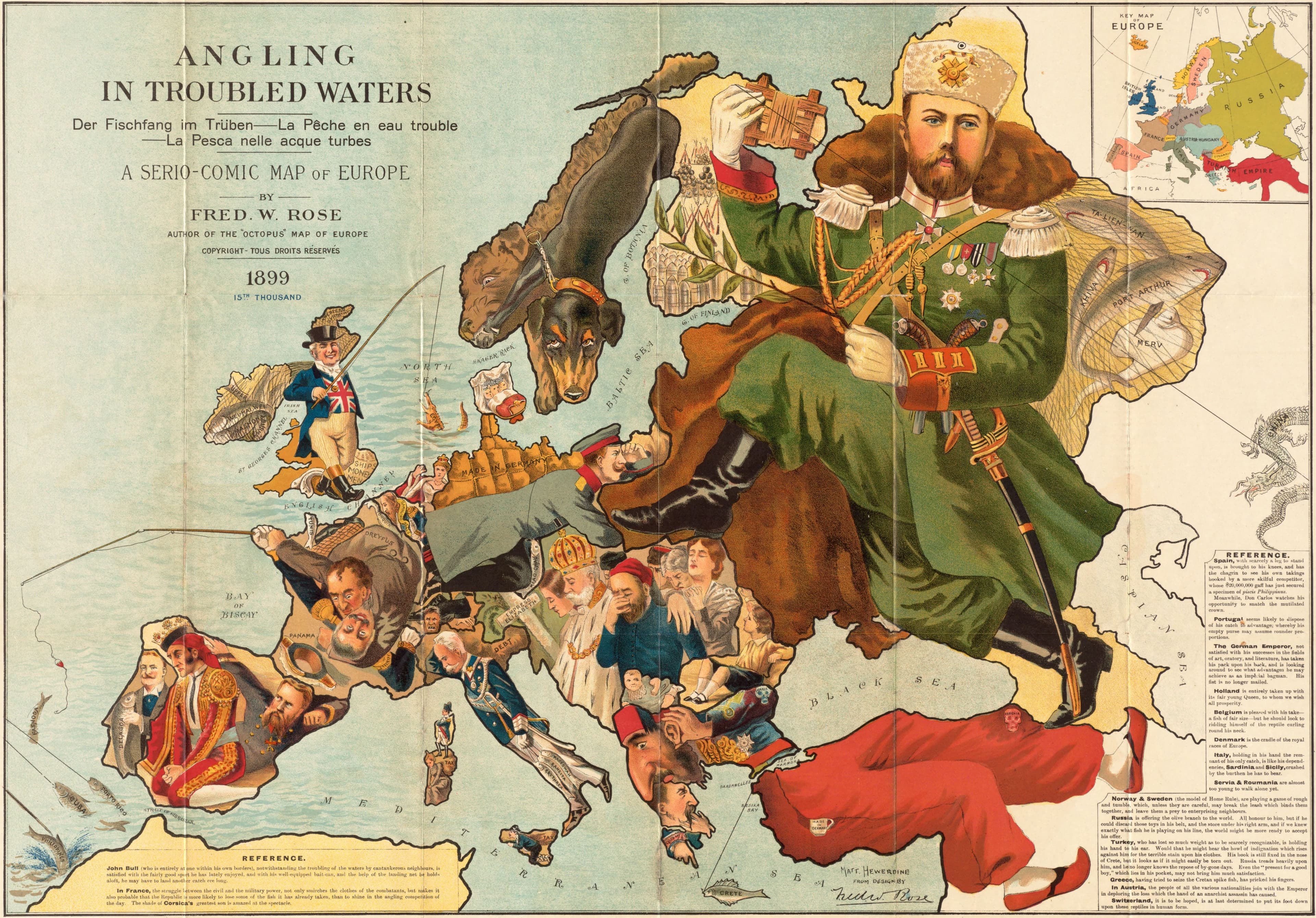
Rose's Angling in Troubled Waters — Angling in troubled waters, Frederick W. Rose, c. 1899

c. 1899

Rose's Angling in Troubled Waters

Every European power, fishing for an empire.

persuasive
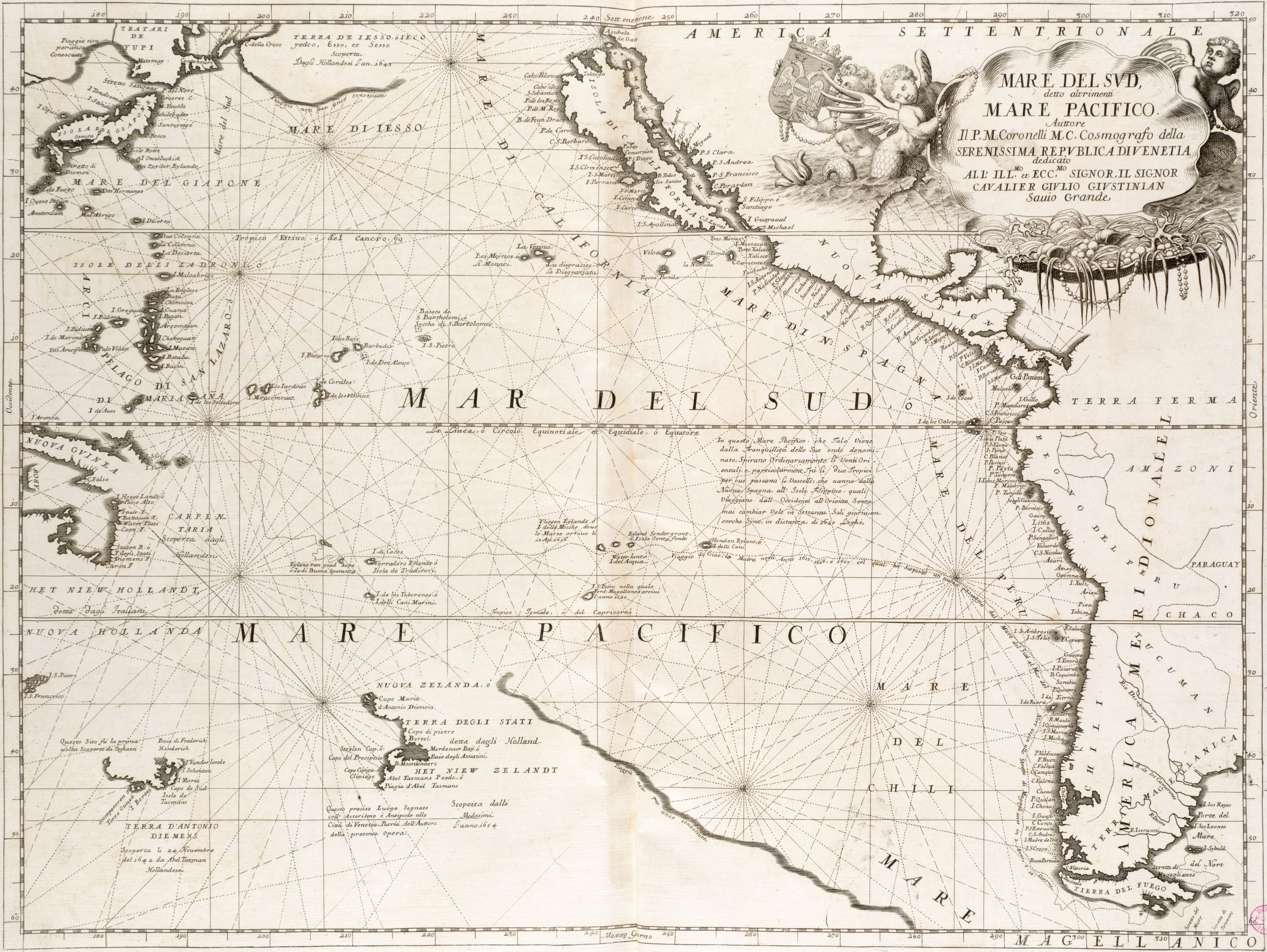
Coronelli's South Sea — Mare del Sud, detto altrimenti Mare Pacifico, Vincenzo Coronelli, 1691

1691

Coronelli's South Sea

The Pacific from Venice, with California as an island.
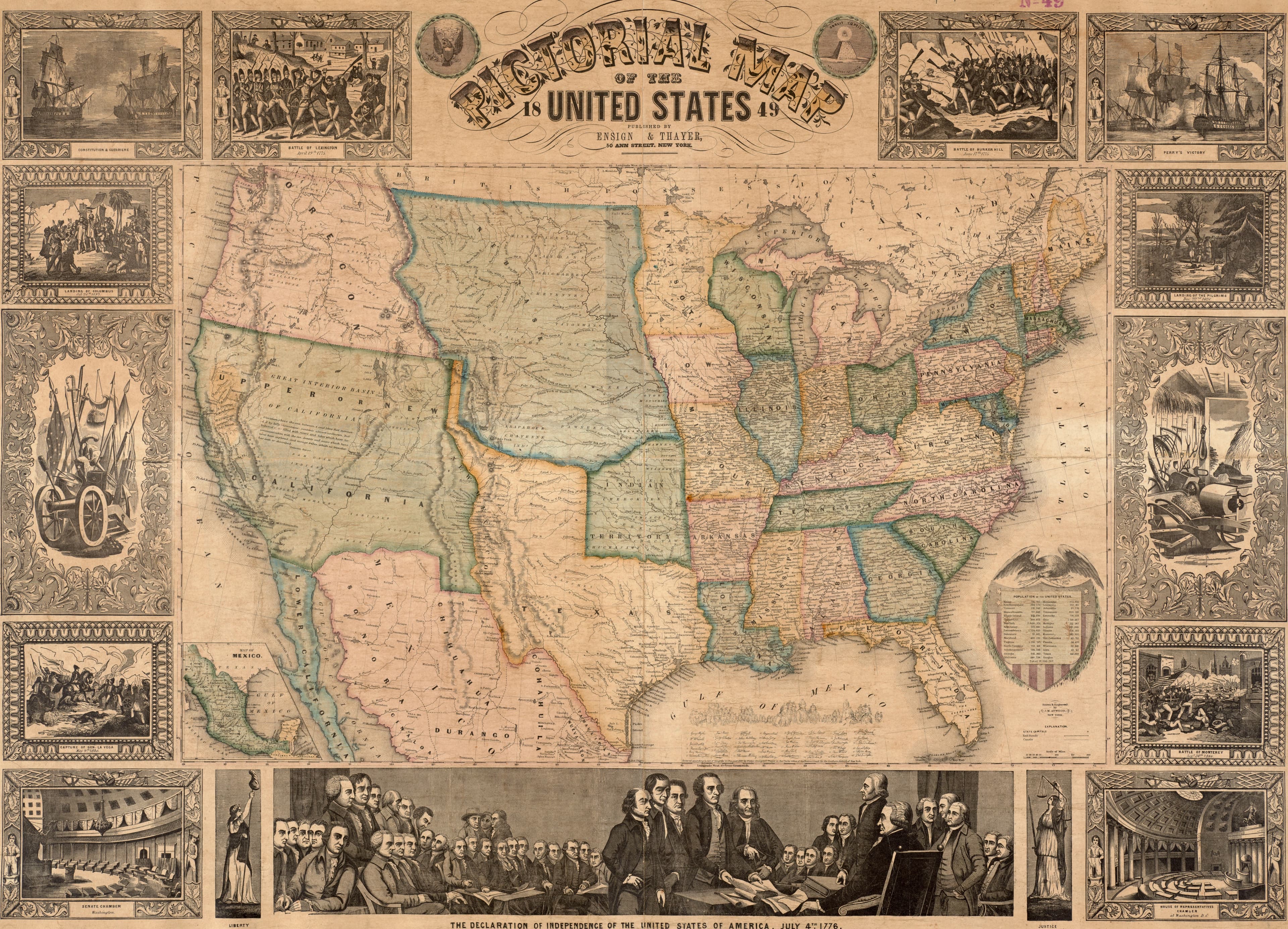
Atwood's Pictorial United States, 1849 — Pictorial map of the United States, 1849, John M. Atwood, 1849

1849

Atwood's Pictorial United States, 1849

The republic at the gold rush, with its signers round it.
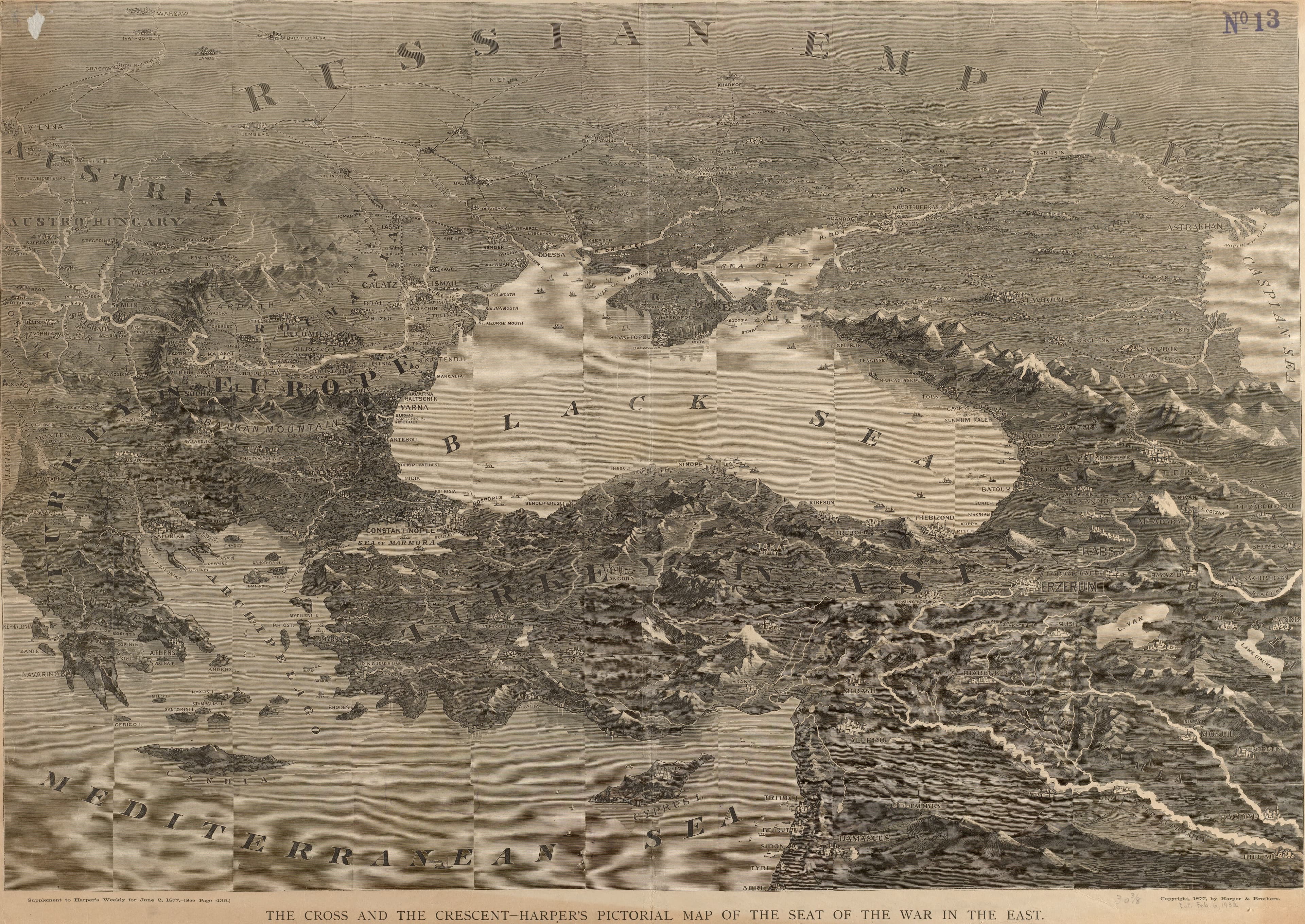
Harper's Cross and Crescent — The cross and the crescent: Harper's pictorial map of the seat of the war in the east, Harper & Brothers, 1877

1877

Harper's Cross and Crescent

The Russo-Turkish war, for an American breakfast table.
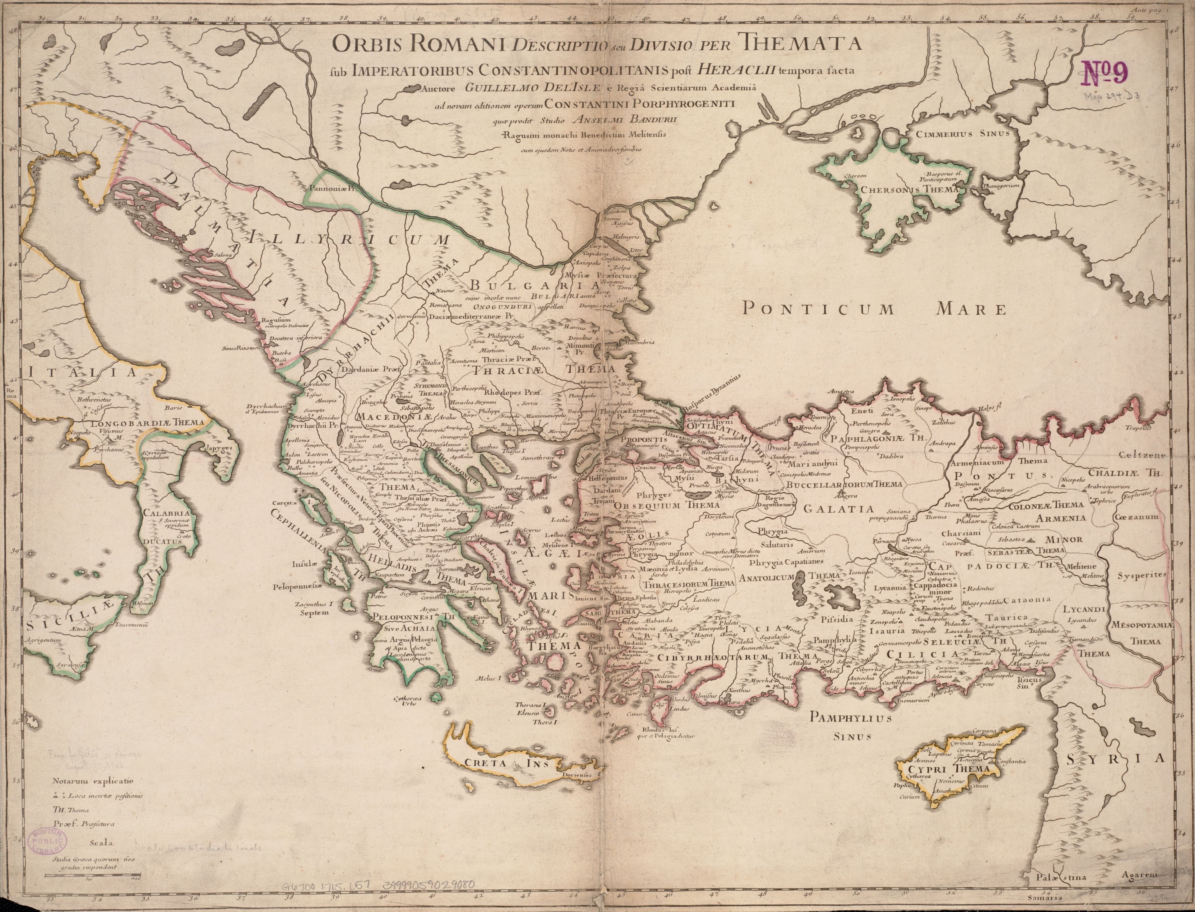
De l'Isle's Roman World — Orbis Romani descriptio, Guillaume de l'Isle, c. 1715

c. 1715

De l'Isle's Roman World

The Roman world, mapped by the king of France's geographer.
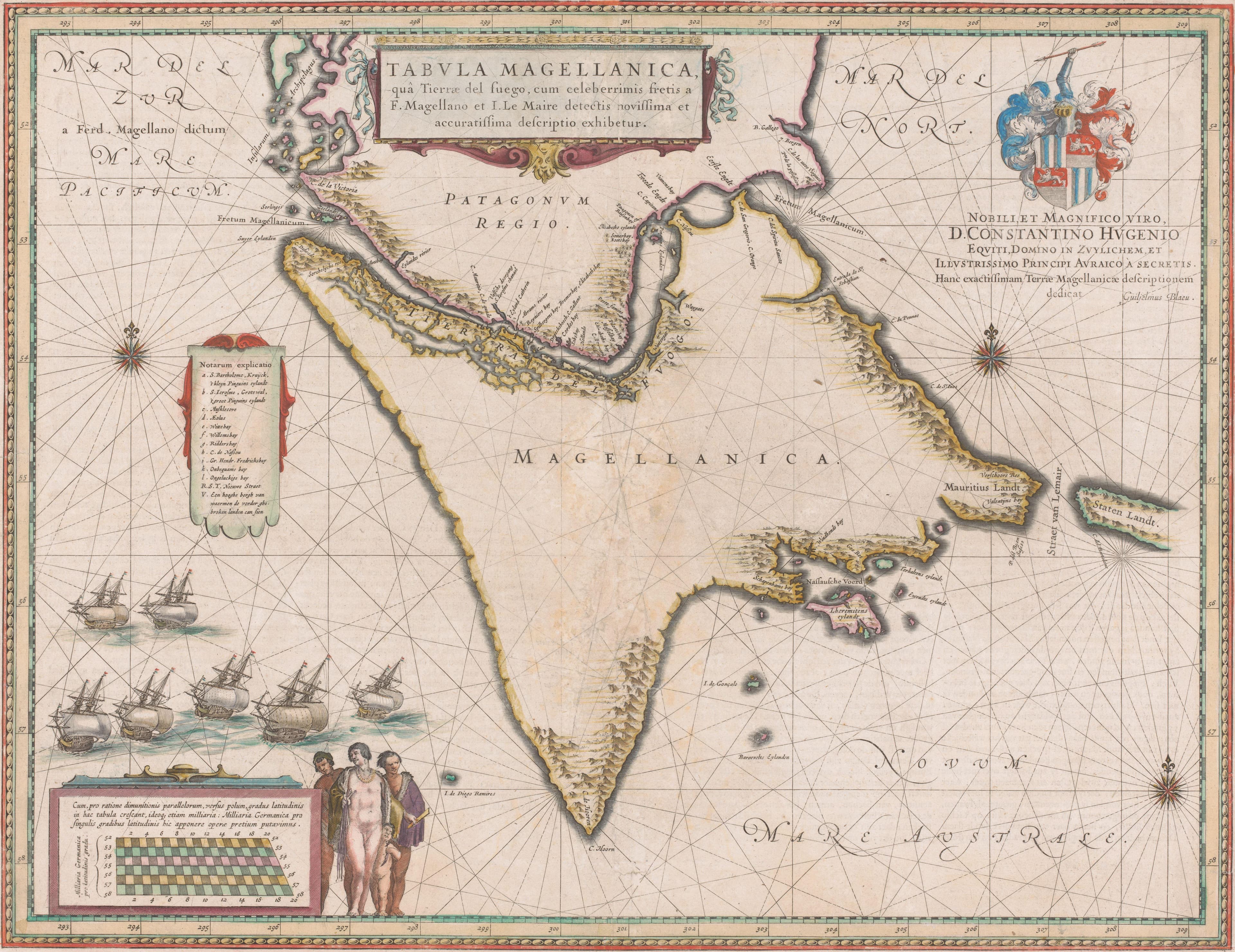
Blaeu's Strait of Magellan — Tabula Magellanica, Willem Janszoon Blaeu, 1635 to 1664

1635 to 1664

Blaeu's Strait of Magellan

The narrow way round the bottom of the world.
John Snow's Cholera Map — Map from On the Mode of Communication of Cholera, John Snow, 1854

1854

John Snow's Cholera Map

The map that traced an epidemic to one water pump.
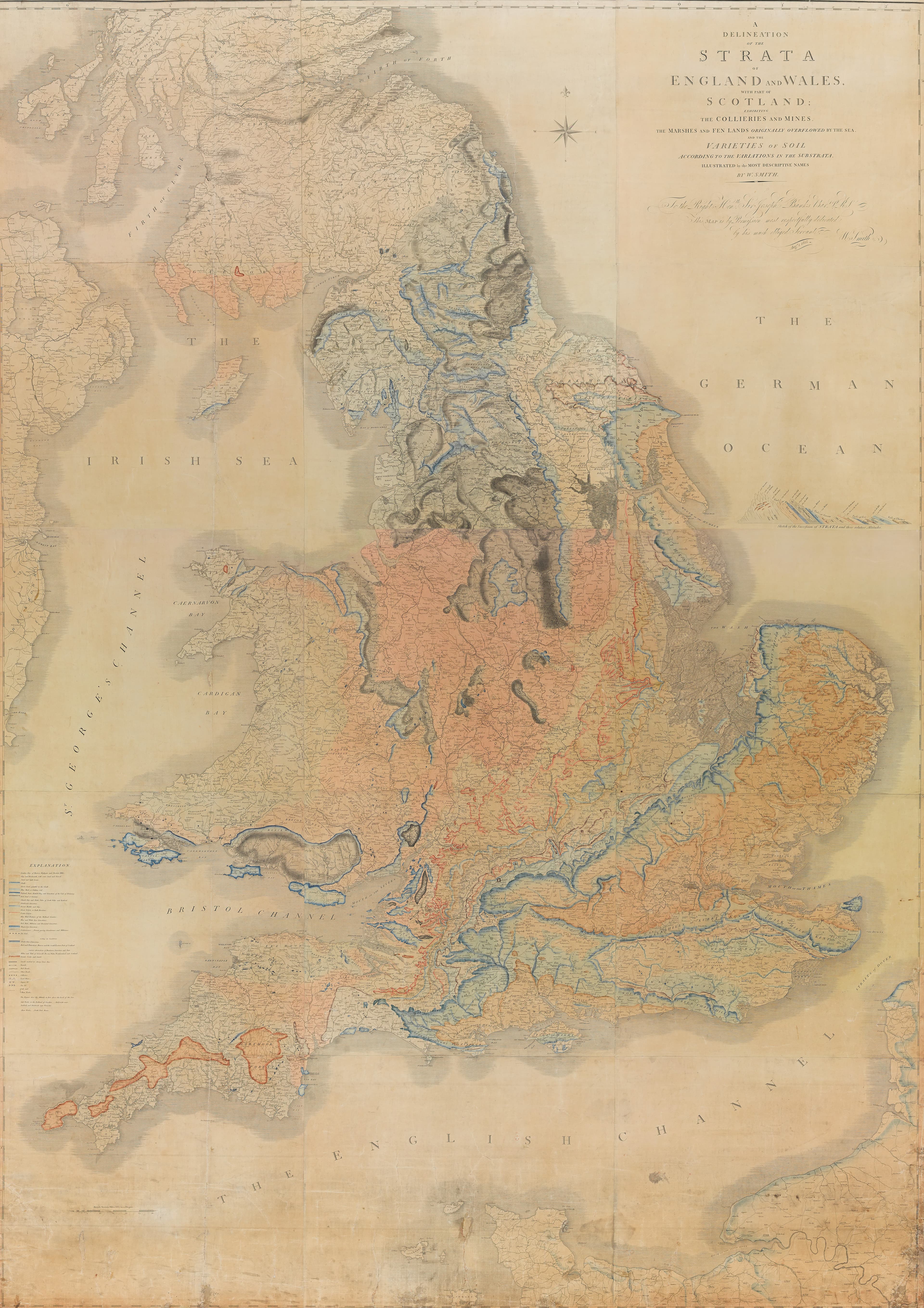
William Smith's Map of the Strata — A Delineation of the Strata of England and Wales with part of Scotland, William Smith, 1815

1815

William Smith's Map of the Strata

The rocks beneath a whole country, in colour.
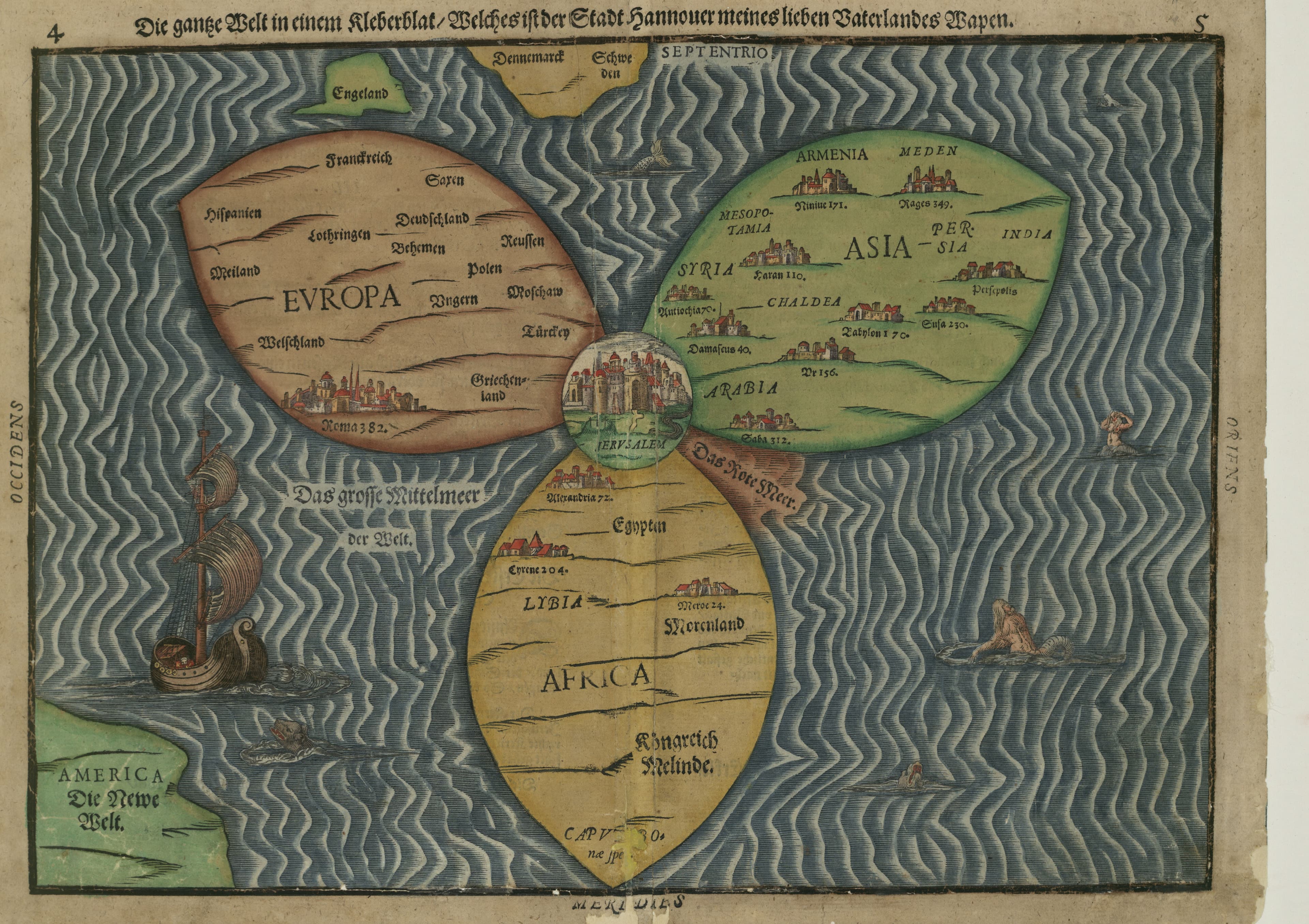
Bünting's Clover-Leaf World — Clover-leaf map of the world, Heinrich Bünting, 1585

1585

Bünting's Clover-Leaf World

Europe, Asia and Africa as one clover, Jerusalem at the heart.