The Continents
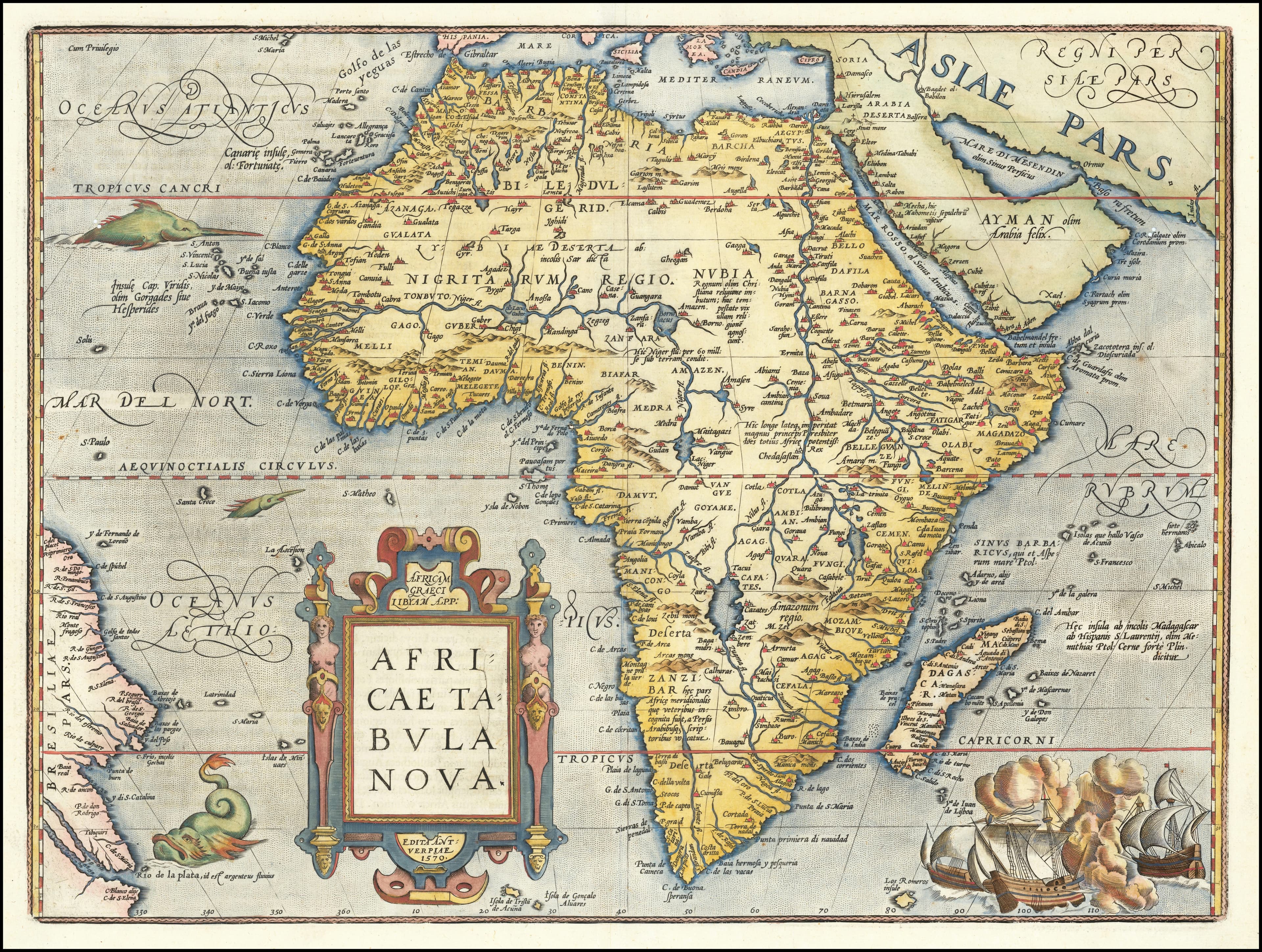
Africae Tabula Nova
sea monsters and full-sail ships in both oceans.
- Map
- Africae Tabula Nova
- Mapmaker
- Abraham Ortelius
- Date
- 1595
- Held by
- Ruderman / Wikimedia Commons
Format
The full-resolution scan, color-managed to the source — yours to print, study, and explore.
Size
$29.00
The story
Ortelius's Africa is confident exactly where it has no business being: the coasts are traced from Portuguese sailing, and the interior is furnished from Ptolemy and rumour, with the Nile rising from two great lakes no European would see for another three hundred years. Ships and monsters fill both oceans. The blank spaces were not left blank — they were decorated, which is a different admission.
About this reproduction
- A faithful reproduction of a public-domain map held by Ruderman / Wikimedia Commons — the work is centuries out of copyright.
- Printed to order on archival cotton-rag or textured laid stock, pigment inks rated 100+ years.
- Color-managed to the source scan; we correct nothing and invent nothing.
- Ships in 5–10 business days, rolled in a heavy-wall tube (framed and linen-backed pieces ship flat-packed).
- If it arrives less than perfect, we reprint or refund — your choice.
Why our maps cost more than a poster: we print from the highest-resolution scans in existence, at sizes where the engraving itself becomes visible — the sea monsters, the tiny place-names, the burin lines — on stock made to outlive its owner.