Mappæ Mundi
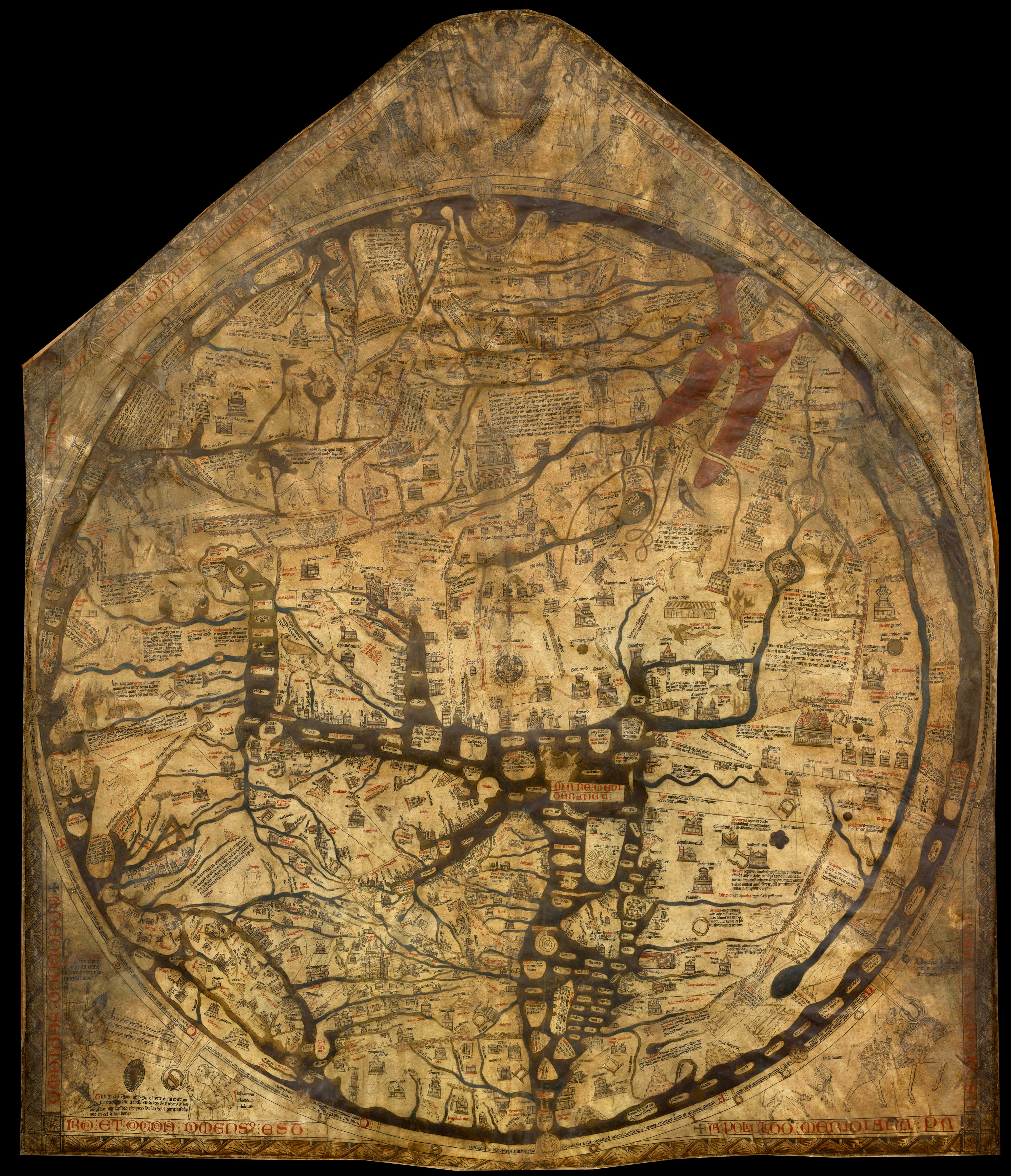
The Hereford Mappa Mundi
The largest medieval map of the world.
- Map
- Hereford Mappa Mundi
- Mapmaker
- Richard of Haldingham (attributed)
- Date
- c. 1300
- Held by
- Hereford Cathedral, England
Format
The full-resolution scan, color-managed to the source — yours to print, study, and explore.
Size
$29.00
The story
This is not a map to find your way by — it is the whole of creation on a single calf-skin. The largest medieval map to survive, the Hereford Mappa Mundi puts east at the top, Jerusalem at the dead centre, and Christ in Majesty presiding over all, judging the world. Around the edges crawl the monstrous races medieval Europe believed lived at the rim of the known — and the Garden of Eden sits ringed in fire. Not geography, but a picture of time, faith, and the shape of the cosmos.
About this reproduction
- A faithful reproduction of a public-domain map held by Hereford Cathedral, England — the work is centuries out of copyright.
- Printed to order on archival cotton-rag or textured laid stock, pigment inks rated 100+ years.
- Color-managed to the source scan; we correct nothing and invent nothing.
- Ships in 5–10 business days, rolled in a heavy-wall tube (framed and linen-backed pieces ship flat-packed).
- If it arrives less than perfect, we reprint or refund — your choice.
Why our maps cost more than a poster: we print from the highest-resolution scans in existence, at sizes where the engraving itself becomes visible — the sea monsters, the tiny place-names, the burin lines — on stock made to outlive its owner.